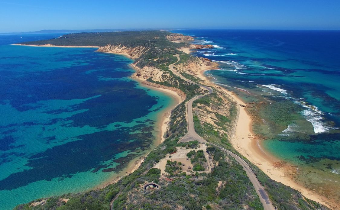
A day visiting Port Nepean is a perfect escape from Melbourne. Just a 90 minute drive will have you discovering the rugged coastal landscape this area is famous for. History lovers will also find much explore military forts and tunnels, the historic quarantine station and more.
Point Nepean is known as Boona-djalang by the Boonwurrung people, the first nations owners of this land.
This page may contain affiliate links. Please see our full disclosure for more details.
Where is Point Nepean?
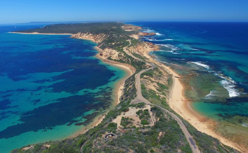
Located on the most westerly point of the Mornington Peninsula in Victoria, Point Nepean offers beautiful views across to Queenscliff and over the Port Phillip Bay Heads. It borders Portsea and is 110km from the Melbourne CBD.
What is there to do at Point Nepean?
In a word, plenty! Walk or cycle the coastal trails, explore the national park, learn about the point’s military past, visit the historic Quarantine station and discover the many Aboriginal archaeological artifacts within the area.
So lets dig into a bit more detail and figure out what you might like to do while you are here.
Point Nepean National Park
Home to one of the most treacherous coastlines in Victoria, Point Nepean National Park offers a beautiful landscape and rich history.
For the Boonwurrung people Point Nepean was a significant place. They would gather here to source shellfish and other food along the coastline. It was also an important birthing site. Currently, there are 70 registered Aboriginal archaeological sites within the National Park, a testament to the volume of people who once lived in the area.
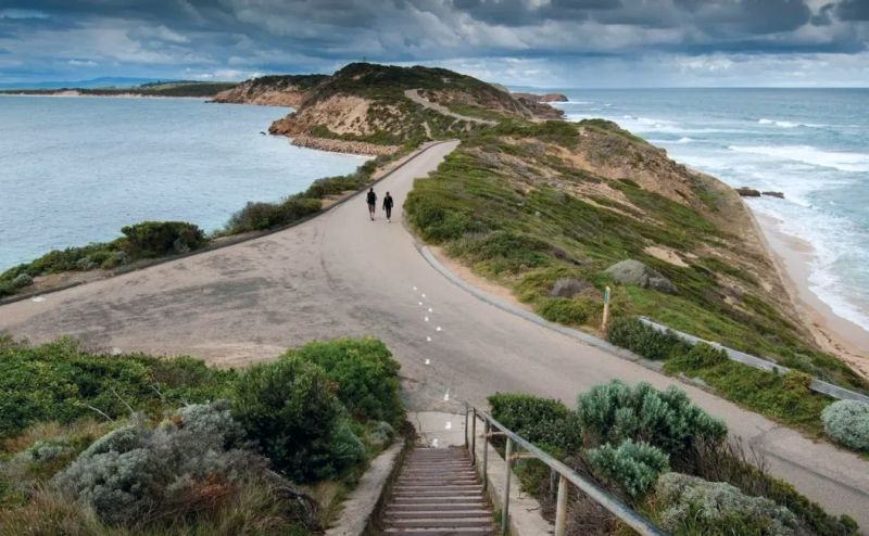
For most of its history, Point Nepean has been off-limits to non-indigenous people. After its use as a Quarantine Station came to an end, extensive military fortifications and defensive works were constructed.
These too were abandoned after the end of the Second World War but it was not until 1988 that the site was relinquished by the Government as a military site and opened to the public.
Point Nepean National Park offers 5 walking tracks so you might want to download the official Point Nepean map here before you visit.
Point Nepean Quarantine Station
The Quarantine Station dates back to 1852 and was used as a fort and army base until 1980. During this time, early European settlers used the Quarantine Station to protect the entrance into Port Phillip Bay.
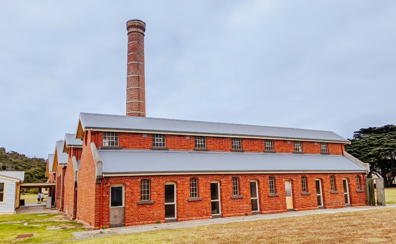
There are almost 50 buildings you can wander through with artifacts dating back to the 1870s. These buildings housed passengers from 305 quarantined ships. Lepers, consumptives, and those suffering from measles, typhus, and Spanish influenza were all housed here.
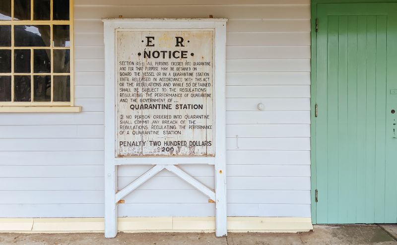
It’s a fascinating destination and you can read a complete guide to how to see the Point Nepean Quarantine Station here.
It is possible to book a 60-90 minute guided tour of the Quarantine Station for groups of 15 or more, through the Nepean Historical Society in Sorrento.
Point Nepean Walks
There are numerous walks you can do within the Point Nepean National Park, the most popular one begins at Gunners Cottage car park and ends at Fort Nepean.
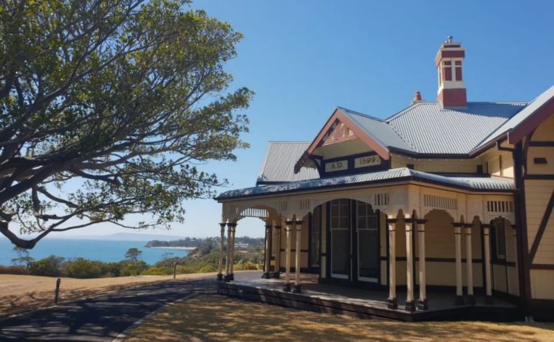
This 3.5km one-way walk is perfectly signposted, mostly flat. With a grade 1 difficulty level it is suitable for most. It will take you between 2-3 hours to complete depending on how fast you walk and how many times you stop to take pictures.
Along the route, you can take in the vastness of the Bass Strait on your left and the (occasional) calmer waters of Port Phillip Bay on your right. If you really don’t feel like walking back, simply jump aboard the hop-on-hop-off shuttle bus that runs between the Quarantine Station and Fort Nepean.
This shuttle bus service runs between the two locations throughout the day between 10 am – 4:30 pm. The shuttle bus tickets can only be purchased from the bus driver who takes cash and card.
Cycle Point Nepean National Park
Another great way to explore all the highlights of Point Nepean National Park is by bicycle. You can hire a bike or an e-bike from the Point Nepean Information Centre to see everything the National Park has to offer on your day trip from the city.
The Information Centre gives out a wonderfully detailed Point Nepean National Park map. The staff are friendly and full of suggestions about the best things to do inside the park.
Fort Nepean
Located on the tip of the mornington the furthest western point of Point Nepean National Park is Fort Nepean. It was built in 1882 and used as a strategic defense site. To this day, it is still considered to be one of the best examples of a major fort complex in Australia.
From here you can get a bird’s eye view of the Port Phillip Heads Marine National Park and watch as giant freight ships cruise below.
You can also wander through the gun emplacements via the extensive barrack tunnels whilst learning more about the famous guns of Fort Nepean used in WWII. Along Defence Road, you will also come to Fort Pearce, Eagles Nest, and Battery Observation Posts.

Once you’ve made it to Fort Nepean, keep walking along the track until you get to the very end of the walking trail to get a complete view of The Rip.
Nicknamed The Rip because of the treacherous waters between Point Nepean, Shortlands Bluff, and Point Lonsdale, it is a force so strong that over the years an estimated 130 shipwrecks lie in the Port Phillip area with over 50 reported to have occurred in The Rip.
If you’d like to be systematic about your exploration, you can take a guided tour – Forts of Point Nepean – for groups of 15 or more by the Nepean Historical Society. See more information in the Further Resources section below.
Point Nepean Beach and Cheviot Hill
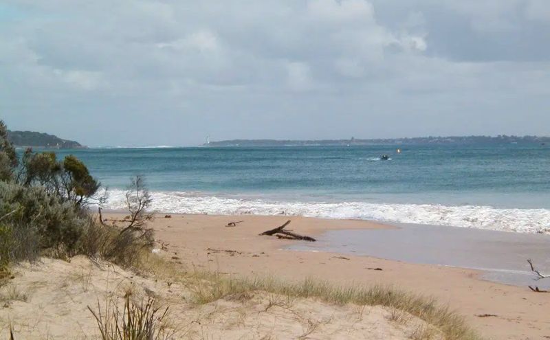
On your way to Nepean Fort, stop off to take in and explore Cheviot Beach, a beautiful stretch of wild and rugged coastline.
Point Nepean Beach is within Mornington Peninsula National Park. It begins at Cheviot Hill and goes out to the point and around to Observatory Point in the bay. Access to these beaches is via walking tracks off Defence Road.
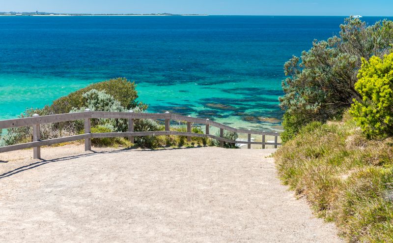
Whilst these beaches are not safe for swimmers and are not patrolled by lifeguards, they are incredible to see. Waves average about 0.5m however tidal changes expose the reef below to reveal a seriously impressive view.
If you are interested in visiting the beaches, be sure to check a detailed Point Nepean weather forecast before you go as conditions can be tumultuous.
The beach has a pretty dark past. It is named after the SS Cheviot which was shipwrecked here in 1887. It’s propellers broke during a storm and it hit the reef in poor weather resulting in the death of 35 people.
This is also the location where former Prime Minister Harold Holt mysteriously disappeared whilst swimming in 1967.
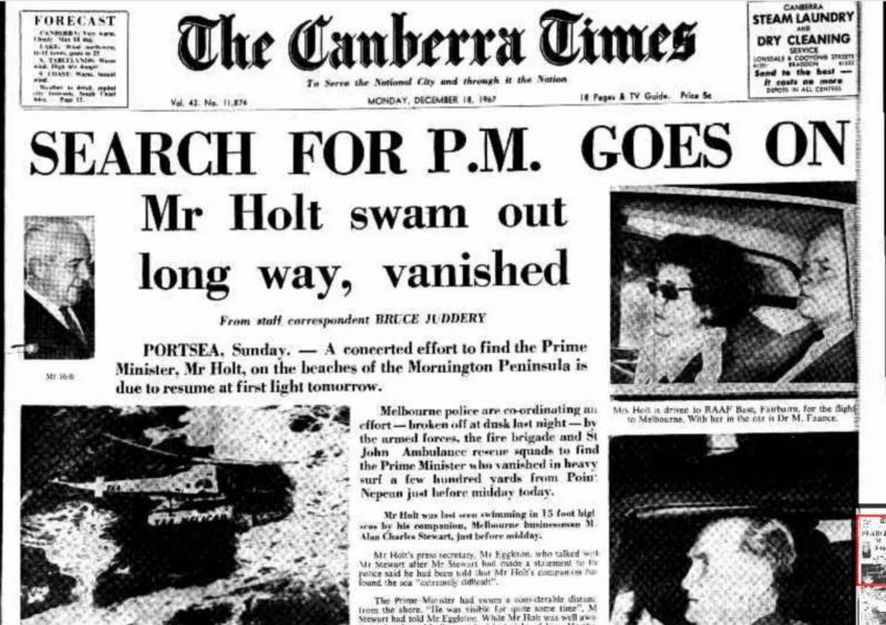
As Harold Holt’s body was never found, many theories ensued.
Once you see how treacherous the beaches here are, it is hard to entertain the conspiracy theories of the day about alleged Cold War espionage, kidnapping, and assassination.
There is a Harold Holt memorial located just near the beach to commemorate his service and acknowledge the tragic way in which he died.
The inscription on the memorial reads:
In memory of Harold Edward Holt, P.C., C.H.,
Prime Minister of Australia from 26.1.1966 until 19.12.1967.
He disappeared while swimming off Cheviot Beach during rough weather on 17.12.1967
Other Highlights of Point Nepean National Park
As you explore this wonderful National Park, you will come across the following landmarks and sites:
- Observatory Point – the remnants of an animal quarantine jetty
- Coles Track – in the 1940s this walk was created to connect Fort Nepean to Melbourne for telegraph services during the Second World War.
- Point Nepean Cemetery – over 300 people are buried here, only 230 of those have been identified. Shipwreck victims, settlers, quarantine victims, and military service personnel are believed to make up the unidentified bodies buried here since 1854.
- Battery Observation Posts and Searchlights near the forts.
- The Range Area – used to train cadets from the Army Officer Cadet School (1952-1985).
- Monash Light was named after a very famous Melburnian, Sir John Monash, who was the Commanding Officer of Point Nepean from 1897 to 1908. The tower is still used for tidal buoy relay transmissions.
- Pearce Barracks – these barracks are interesting because from 1943 they were home for a time to the Australian Women’s Army Service (AWAS).
- Gun Emplacements – there are six lots of these – see if you can find them all!
- Engine House – The Engine house produced electricity from a coal boiler and was built in 1882. These days, the Visitor Centre used solar energy.
- Parade Ground and Gun Barrels – these gun barrels are significant for their role in military history. Known as Barrel 1489 and Barrel 1317, the former was used to fire the first shot of World War I for the British Empire. Barrel 1317 was used to fire the first shot of World War II for Australia.
- And finally, the very interesting Tunnels of the Gun Emplacements are free to wander through!
How to Get to Point Nepean
- Point Nepean is located approximately 115 km or just 1.5 hour’s drive from Melbourne’s CBD. Simply follow the M1 before joining the M11 Mornington Peninsula Freeway all the way to the end until you reach Portsea. Just a little further along and you will find the entrance to the National Park.
- From Melbourne, it is easy to take the train to Frankston. From Frankston, the 788 bus goes to the National Park entrance.
- From Portsea, it is a 12-kilometer round trip so it is possible to walk or cycle.
Most Common Questions About Point Nepean National Park
- Can I swim at the beach?
Yes. The quiet and beautiful bayside beach is a one-minute walk from the free car park. - Can I camp?
No. There is no camping. In fact, there is no Point Nepean accommodation at all. Portsea begins just outside the Park entrance. - Are guides available?
No, but there is a free audio guide available at the Visitor’s Center. However, there are guided tours for 15 or more people of the Quarantine Station and the Forts of Point Nepean. These can be booked through theNepean Historical Society website. - Can you take dogs?
No, as it is a National Park dogs are not allowed. - Are there BBQ and picnic facilities?
There are picnic shelters but not BBQ facilities. - Can I fish?
Yes, from the Quarantine Foreshore. The Visitor’s Center has a map marking the areas where fishing is permitted. You will need a fishing permit. You can get one at the Mornington Peninsula Visitor Information Centre (1800 804 009)
Further Resources
- Nepean Historical Society is located in nearby Sorrento (827 Melbourne Road). The Society has a number of guided tours available to book through their website. These include 60-90 minute tours of the Quarantine Station and 90-120 minute tours of the Forts of Point Nepean. Their website is Nepean Historical Society. I have found them to be delightful and helpful.
- Now that you’ve seen the Mornington Peninsula, you must see the other side of Melbourne’s coastline: the Great Ocean Road and the 12 Apostles. Get my Great Ocean Road Holiday Complete Planning Guide.
Have questions about exploring Australia?
Head over and join our Facebook Group and we will be happy to help

