11 Challenging Multi-Day Hikes in Australia
Looking for a challenge? There are several fabulous multi day hikes in Australia. There’s nothing quite like taking a 2 or 3 day hike across some wild country to really see the best Australia has to offer. So if you’re wondering about the best multi-day walks in Australia, read on!
With ample sunshine, scarce rain, and incredible natural scenery, Australia is one of the world’s best-hiking destinations. Home to an incredible 685 National Parks, packed with gorgeous plants, rare animals, and stunning vistas, hiking in Australia is always an amazing experience.
This page may contain affiliate links. Read our full disclosure policy for more information.
Preparing for multi-day hikes in Australia
Before we start, a quick note on safety: hiking in Australia is often remote and challenging. Multi-day hikes are recommended for experienced hikers with a good level of fitness.
- Ensure you’ve got all the essentials (adequate water and food, sunscreen, appropriate clothing, bug spray, good boots, a first aid kit, and maps).
- Please don’t rely on mobile phone signals, as they often aren’t available.
- Register your itinerary with the National Parks Service or with the local police and be sure to notify someone when you’re expecting to return.
- Some locations will rent you an emergency locator beacon so that you can be quickly found in an emergency (e.g. storm, injury, getting lost, etc.).
- Consider the terrain you are entering and make sure you have the right gear for the weather.
If you are not experienced, you can still enjoy these hikes, but we recommend joining a licensed organised group. There is also the option to hike in comfort with experienced operators’ various day treks to help you develop your hiking skills.
I highly recommend the book How to Navigate by Caro Ryan. If you are serious about hiking, you really should consider master basic navigation skills.
Light to Light Walk, New South Wales
First up is the Light to Light Walk in Ben Boyd National Park. Located in the Green Cape area of the park, on the far south coast of New South Wales, this is a stunning coastal walk.
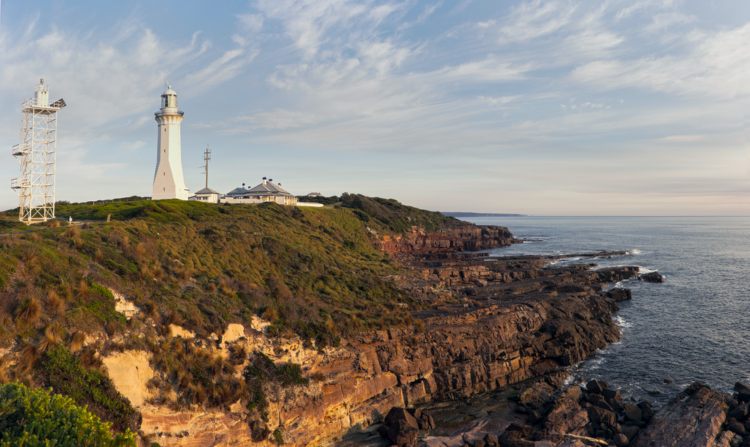
The name comes from the two imposing lighthouses (Boyd Tower and Green Cape Lighthouse) that mark the start and finishing points of this walk.
Join a 4 day guided tour of the Light to Light walk
The trail runs along the coastline for almost the entire length, with brief detours into woodlands, across high rock platforms and past sheltered coves. Whales, seals, and sea birds are common sights along the hike, and some of the shorter sections are popular as day hikes.
Distance: Clocking in at 30 kilometres
Recommended time: most people take three days to hike the full trail, with overnight stops at Saltwater Creek campground and Bittangabee campground.
Best time to walk: Conditions are best during spring, summer and autumn, as the NSW South Coast can get very cold during the winter!
Find out more on the official NSW National Parks site.
The Six Foot Track, New South Wales
Located in the Blue Mountains National Park, just on the western edge of Sydney, the Six Foot Track is well known as one of Australia’s best multi-day hikes.
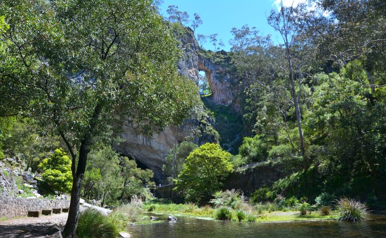
Starting from the famous Explorer’s Tree on the Great Western Highway near Katoomba, the trail runs westward through temperate rainforest, along the Megalong Valley floor, and across Cox’s Creek, before eventually arriving at Jenolan Caves.
The track is not an easy walk and requires at least a good fitness level; there’s quite a lot of uphill and downhill sections to cover.
Aside from the gorgeous bushland and imposing rock escarpments, the Track passes historic Megalong Cemetery, across Bowtells Swing Bridge, and underneath the spectacular Carlotta Arch. The track’s unusual name speaks to its origins as a historic horse track – it was constructed six feet wide so that two fully loaded drays could pass each other.
Distance: The Six Foot Track is an imposing 45 kilometres
Recommended time: It’s usually recommended to spend three days walking the Six Foot Track, staying at Coxs River Campsite and Black Range camping ground, but you’ll pass other campgrounds too, so you can spread the journey out if necessary.
Best time to walk: It’s best to tackle the Six Foot Track in the warmer months, but be sure to check bushfire conditions before setting out. Fire is a real risk in the Blue Mountains.
Once you’re finished, don’t miss Jenolan Caves, often considered Australia’s most impressive cave system.
Twelve Apostles Lodge Walk, Victoria
The most famous natural feature in Victoria is the iconic Twelve Apostles, located along the Great Ocean Road west of Melbourne. The Great Ocean Walk is the best way to experience this stunning natural landmark.
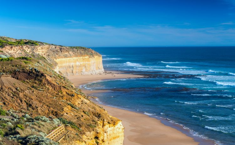
Although driving the road is fantastic, hiking the area instead is even better – getting you better access and more striking views than those available from the road. And what’s even better than hiking the Twelve Apostles? Staying in luxury while someone carries your luggage each day!
The Twelve Apostles Lodge Walk is one of Australia’s best hikes and runs from Castle Cove in the east to the Twelve Apostles themselves in the west.
The three-day journey covers three discrete sections of the trail and includes morning drop-offs and evening pickups. Each night you’ll stay in glamping tents, with gourmet meals, and local guides accompany you during the day. Most of the walk is fairly flat, so without a heavy gear load and no enormous hills, the Twelve Apostles Lodge Walk is definitely one of the more relaxed options.
Distance: 46km
Time to complete: Organised tours usually run 3 days, and most individual walks do the same.
Best time to walk: It’s best to visit in the warmer months, though any time of year is fine. The weather here can be very unpredictable, so you may have perfect blue skies or torrential rain – or both!
While you are in Victoria, be sure to spend some time exploring the Grampians
The Australian Alps Walking Track, Victoria
One of the longest walking routes in the country, the Australian Alps Walking Track stretches for a colossal 655 kilometres between Walhalla in Victoria and Tharwa in the Australian Capital Territory. Hike through Mount Kosciuszko Australia’s highest peak.
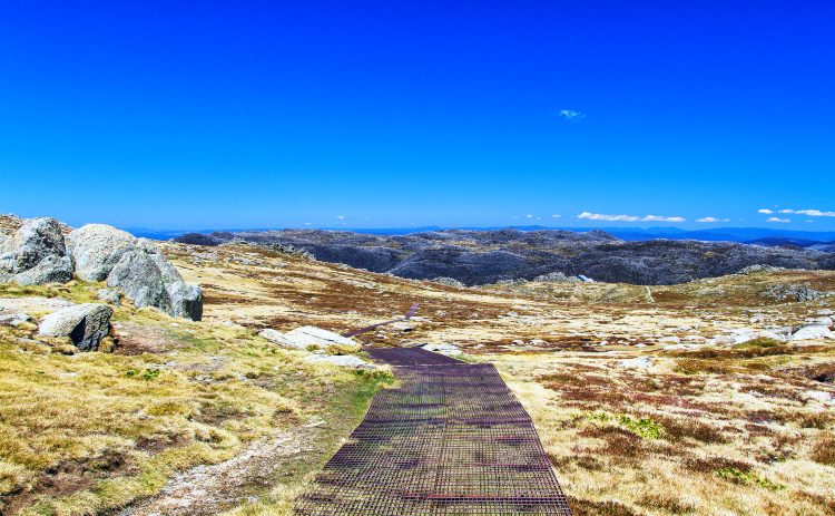
Sticking largely to high plains, moors, and ridges, the track traverses five separate national parks (Baw Baw, Alpine, Kosciuszko, Namadgi, and Brindabella). It ascends the highest points in each of New South Wales, Victoria, and the ACT.
You can experience shorter treks, including a walk from Thredbo where the Kosciuszko Express Chairlift does some of the work for you!
Distance: 665km
Time to complete: Expect to take a 35-50 days or longer to complete this walk.
Best time to walk: Best completed in spring and summer.
Scenic Rim Trail, Queensland
Located about 90 minutes drive from Brisbane in south-east Queensland, the Scenic Rim Trail is one of Australia’s newest multi-day hikes.
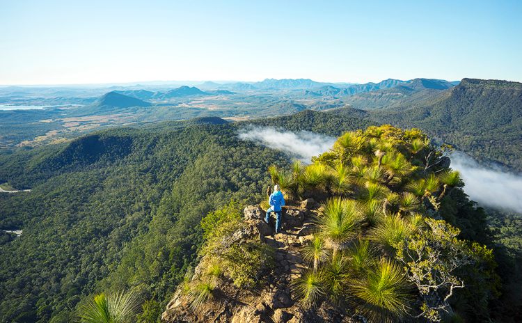
It runs through the incredible Main Range National Park and skirts the edges of the Gondwana Rainforests of Australia UNESCO World Heritage Area, crossing mountain ranges, escarpments, and river gullies.
Although the walk itself is only 47 kilometres, it’s quite a rough and difficult hike. There are multiple very steep sections, and parts of the track aren’t particularly well formed, so navigation experience is necessary. You’ll also need to hike the trail from north to south, as directional markers are only visible when navigating southwards.
The trailhead is at Thornton View and immediately starts with several challenging uphill sections. The views from the ridges and cliff-lines are magnificent, and on a clear day, you can see Brisbane, some 110 kilometres distant. Keep your eye out for giant spear lilies as well before arriving at Mount Mistake campsite for the night.
From Mount Mistake to Castle View camp, Day two is easier, with shady eucalypt forest and fewer uphill sections. There’s also some magnificent alpine rainforest in this area. Day three travels from Castle View to Banshee camp, with plenty of lookouts, rainforest, and mountain streams. The final day from Banshee camp to Cunninghams Gap is moderate difficulty, with more rainforest, fantastic views, and merciful downhill sections!
If you’re not up for roughing it after days of intense walking, there are several options for guided luxury tours along the Scenic Rim Walk. Most of these tours run for five days and nights and feature luxury eco-retreats, walking guides, meals, and luggage transportation.
Distance: 47km
Time to allow: 4-5 days
Best time to walk: April to September
Thorsborne Trail, Queensland
Situated on spectacular Hinchinbrook Island in tropical north Queensland, the Thorsborne Trail is a fantastic four-day coastal trek. Following the island’s eastern coast between Ramsay Bay and George Point, the Thorsborne Trail features incredible tropical scenery in a largely unspoiled paradise.
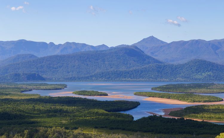
You’ll encounter dense rainforests, swampy mangrove forests, pristine beaches, thundering waterfalls, and beautiful forest – all of it remote and well-preserved. It’s considered one of Queensland’s best multi-day hikes and certainly one of Australia’s hidden gems.
If you intend to tackle the Thorsborne Trail, you’ll need to book ahead. Only 40 people are allowed to camp on Hinchinbrook Island at a time, so be sure to organise your free camping permit well in advance.
And a final note – Hinchinbrook Island is crocodile country, so be sure to take appropriate croc safety precautions.
Distance: 32 kilometres
Time to allow: the trail usually takes about four days to complete and crosses a surprising variety of landscapes.
When to walk: Thorsborne Trail is best during the cooler months of April-September, which happily coincides with the dry season.
Cape to Cape Track, Western Australia
One of Australia’s best hikes is the incredible Cape to Cape Track, located in Western Australia’s Margaret River region.
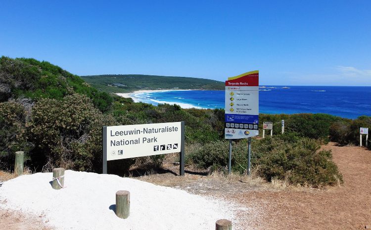
It follows the rugged and remote coastline of south-west WA for an enormous 123 kilometres between Cape Naturaliste and Cape Leeuwin, running mainly within the Leeuwin-Naturaliste National Park.
Hiking the Track is a real treat, with Western Australia’s magnificent coastline on full display. You’ll see rugged headlands, sandy beaches, rivers and waterfalls, dense forests, flower meadows, and glorious views of the Indian Ocean. Whales, dolphins, and seals are all common sights, depending on the time of year, and you can expect to see plenty of bird and insect life as well.
Distance: 123km
Time to allow: The huge distance typically takes between 5-7 days for the average hiker, but there’s plenty of vehicle access points, allowing trekkers to split the full length into several distinct sections.
Best time to walk: The Cape to Cape Track is best in spring or autumn, with moderate temperatures and placid conditions. The sea breezes during summer keep temperatures acceptable, while hiking in winter will definitely require warm clothing.
Heysen Trail, South Australia
Located in South Australia, the Heysen Trail is the longest dedicated walking trail in Australia. Clocking in at an eye-watering 1,200 kilometres, the trail stretches from Cape Jervis on the Fleurieu Peninsula all the way to Parachilna Gorge in the Flinders Ranges.
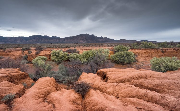
As you’d expect of such a long-distance hike, the trail covers a mind-boggling array of landscapes, with beaches and sea cliffs in the south, forests, gorges, vineyards and farmland in the Adelaide Hills, to the baking heat and rugged hills of the outback.
Highlights of the Heysen Trail include hikes through the Fleurieu Peninsula, the Adelaide Hills, Mount Lofty Ranges, and Mount Remarkable National Park.
No time to do the whole walk? Choose from these 17 short walks on the Heysen Trail
Time to allow: A full journey along the entire trail typically takes around sixty days, though there’s plenty of shorter sections that are well worth doing.
Best time to walk: It’s best to attempt the Heysen Trail in spring or autumn, as winter can get cold, particularly inland and in elevated areas. The Trail is entirely closed during fire danger season, generally between November and April – though this can vary each year.
Freycinet Experience Walk, Tasmania
The north-eastern coastline of Tasmania is generally considered one of the island’s most beautiful locations, and the Freycinet Experience Walk is a fantastic way to explore the area.
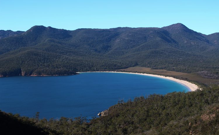
Highlights include the world-famous Wineglass Bay (an Instagram favourite!), along with Coles Bay, Oyster Bay, Mount Mary, and the fascinating White Water Wall. Unlike many of the self-guided hikes we’ve highlighted in this article, the Freycinet Experience Walk is a guided experience featuring luxury accommodation each night, delicious food and beverages, knowledgeable local guides, and of course, transportation as well.
Many tourists in the area make a brief visit to Freycinet, taking a few quick photos at Wineglass Bay before moving on. But to truly appreciate and enjoy this incredible part of Tasmania, it’s hard to beat a fully catered and guided multi-day hike.
Distance: A total distance of 37 kilometres
Time to allow: The Freycinet Experience Walk is a four day journey around the stunning Freycinet Peninsula.
Best time to walk: Conditions are best in the warmer months, as bushfire risk in Tasmania is minimal, and the island can get extremely cold by Australian standards during winter!
Related: Six great hikes in Tasmania worth checking out
Overland Track, Tasmania
The Overland Track, in north-western Tasmania, is considered one of the best multi-day walking tracks in Australia, possibly even the world. It traverses the Cradle Mountain-Lake St Clair National Park in a remote and isolated area of Tasmania, within the Tasmanian Wilderness UNESCO World Heritage Area.
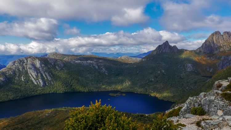
Hiking the Overland Track is magnificent, as it runs through incredible alpine scenery, with glacial valleys, moorlands, alpine meadows, temperate rainforests, and of course, eucalypt forests as well. You’ll also encounter streams, lakes, waterfalls, and some of Tasmania’s highest and most beautiful mountains. Wildlife is a common feature of the Track, too, with pademelons (small wallabies), wombats, currawongs, and much more.
Distance: The track runs for 65 kilometres between Cradle Mountain and Lake St Clair, though many hikers opt for a 17-kilometre extension on the final day, traversing the shore of Lake St Clair rather than taking a ferry across the Lake.
Time to allowThe Overland Track usually takes six days, and there are six public huts located at various points along the way.
Best time to walk: Spring or summer, with warm days, long daylight hours, and the lowest chance of rain. Numbers are limited in summer, and advance permits are required, so get in quick! Space in public huts can’t be reserved, so hikers are required to carry a tent.
The Larapinta Trail, Northern Territory
Located near Alice Springs, in central Australia, the Larapinta Trail is one of Australia’s best multi-day walks. Running an incredible 223km from the Alice Springs Telegraph Station to the peak of Mount Sonder, the trail follows the spine of the West Macdonnell Ranges, in the heart of Australia’s Red Centre.
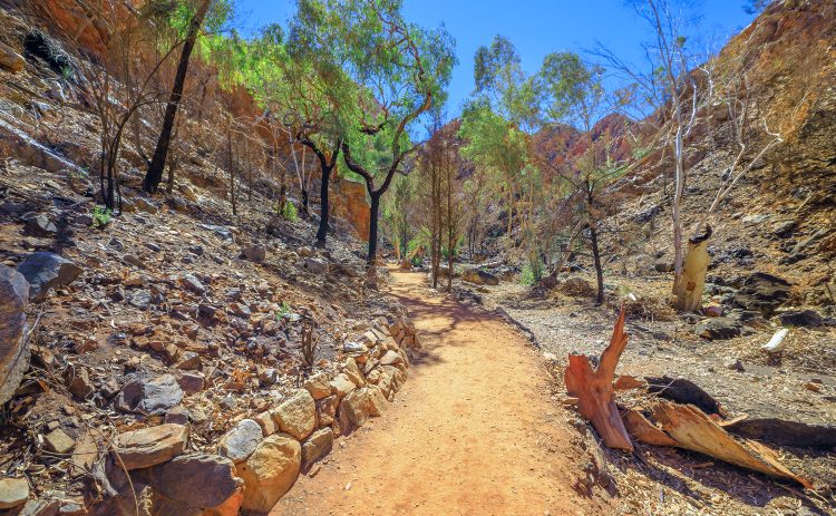
Highlights include Simpson’s Gap, Counts Point, Standley Chasm (Angkerle), Ormiston Gorge, and of course Mount Sonder (Rwetyepme), the fourth-highest point in the Northern Territory.
The scenery along the Trail is absolutely incredible, with rugged red mountains, green scrublands, and the most amazing desert sunrises and sunsets.
Distance: A full journey is 230 kilometre, but the walk is broken up into 12 discrete sections, each of which can be tackled separately as individual overnight hikes.
Time to allow: Walking the full trail typically takes 13-15 days,
Best time to walk: Conditions are best from May-September. Average daytime temperatures are in the mid-20s (and can still get well into the 30s!), while overnight conditions can drop to freezing and worse. Be sure to prepare for all weather.
If you are heading to Uluru, check out our guide to walks around “the rock”.
Want more walks? Consider these:
- Fraser Island Great Walk in Qld
- Gold Coast Hinterland Great walk in Lamington National Park
- South Coast Track in Tasmania
- Kings Canyon Rim Walk
- Bibbulmun Track in WA.
- Bay of Fires Walk in Tas.
Have questions about exploring Australia?
Head over and join our Facebook Group and we will be happy to help

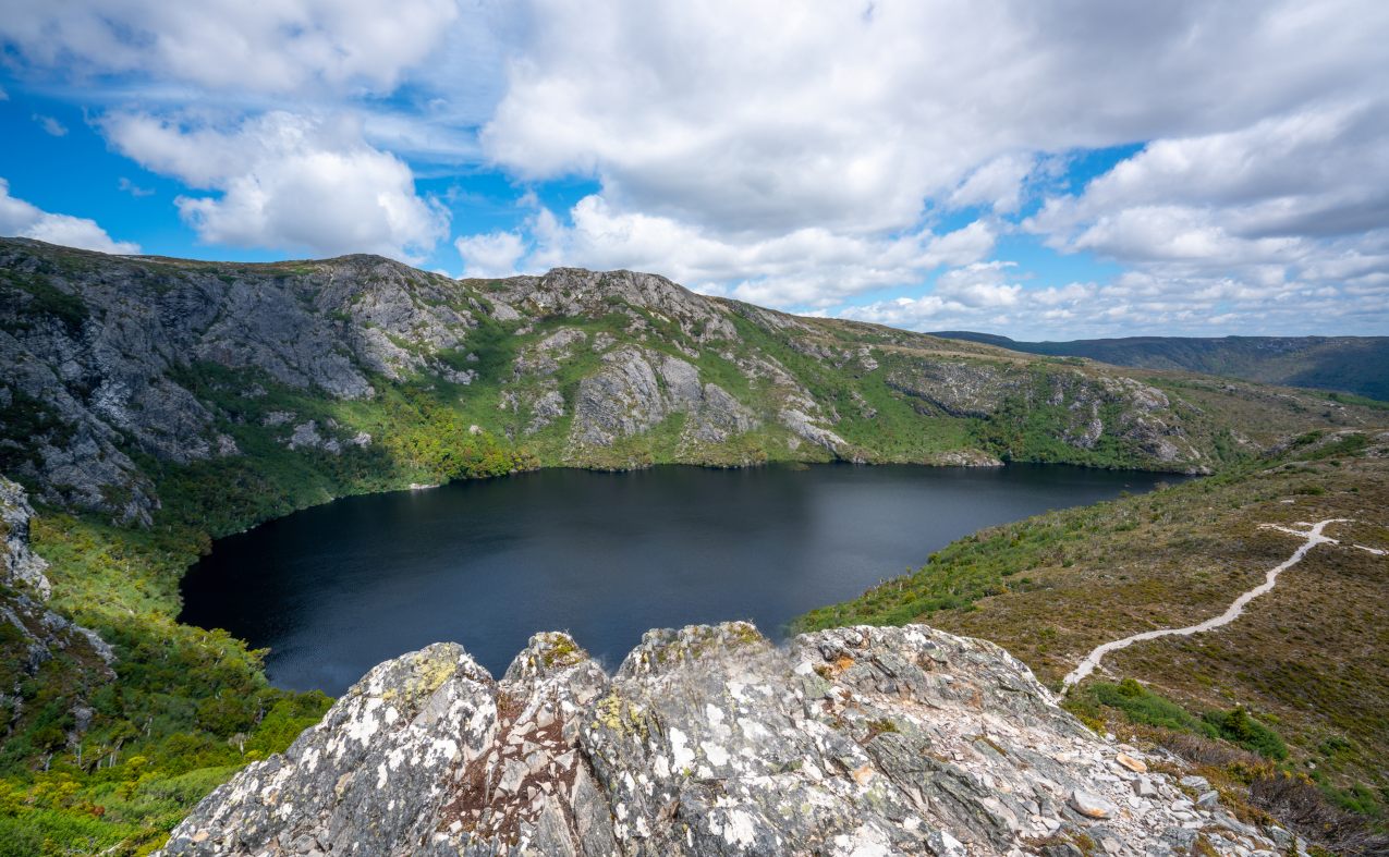
So many of these that I want to do! I was supposed to do the Cape to Cape with a friend in May last year but… well… hoping to tackle the Larapinta and Overland Track in 2022!