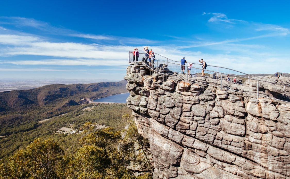
10 of the Best Day Hikes in Australia
Completing any of these day hikes in Australia is a great addition to your plans. There’s no better way to explore the amazing natural landscapes of Australia than by getting out there on two feet and going for a hike. Whether you’re wanting to explore Australia’s coastline, its deserts or its alpine regions, head out on one of these top day hikes in Australia.
Varying in length from an hour or two to full day adventures, some of these day hikes around Australia are within cooee of major cities, while for others the journey to get there is a part of the fun. How many of the best day hikes in Australia have you already checked off, or will you tick off one on your next Australian adventure?
This page may contain affiliate links. Read our full disclosure policy for more information.
Ascending Mt Gower on Lord Howe Island (NSW)
Lord Howe Island is a 10km-long volcanic island in the Pacific Ocean off the east coast of Australia, a two-hour flight from Sydney. While it’s possible to just spend a holiday there lazing on the beaches and enjoying the great snorkelling and diving, there are also some terrific hikes.
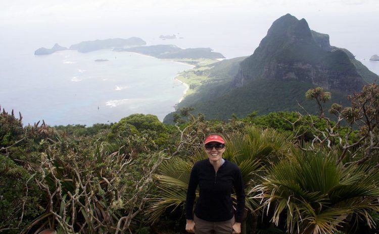
The ultimate day hike on Lord Howe Island is the ascent of Mt. Gower. The highest mountain on the island, it rises 875m directly up from the shore. A full day challenge can only be undertaken on a guided walk. This is mainly because of a dangerous section not long after the start, where you walk along a skinny track halfway up a cliff, assisted by a rope and protected by helmets.
There’s also some tough clambers up rock faces assisted by ropes later on, before you emerge into forest surrounded by nesting birds, then arrive at the summit for a gorgeous vista of the island.
Make sure you book in a massage for after you’ve ticked off this challenge!
Location: Off the coast of New South Wales – see the map
Length: 3.9 km
Difficulty: Moderate to Hard
The Coast Track in the Royal National Park (NSW)
The Coast Track in the Royal National Park, an hour south of Sydney, is technically an overnight hike. Most people break up the 27km walk by camping overnight at North Era Beach. However, if you move quickly, you can do it in a day. Alternatively, it’s possible to hike a shorter section of the track.
One popular option is to drive to Bundeena, or reach the village on the ferry from Cronulla, then hike south to the treacherous Marley Beach, returning via the same route. Along the way, you’ll experience the magnificent cliffs and heathland scrub in the park’s north.
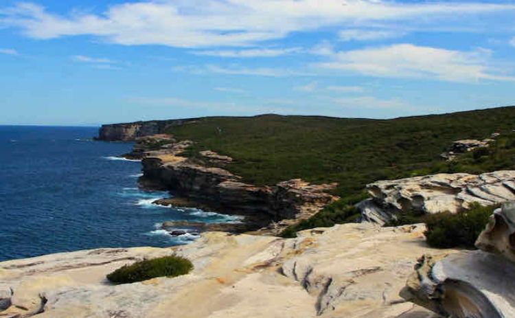
Alternatively, start at the southern end of the Coast Track, near Otford. Then hike north through the Palm Jungle to Burning Palms, a great swimming beach, for a different experience. Note that they only patrol this beach on Sundays in summer, plus Saturdays in December and January. Also nearby is the popular Figure Eight Pools.
Location: Royal National Park, New South Wales – see the map
Length: 27km
Difficulty: Easy to Moderate
Katoomba Cliff Walk in the Blue Mountains (NSW)
The Blue Mountains are another popular Australian hiking destination close to Sydney. While there are also magnificent hikes to be done at Wentworth Falls and in the Grose Valley, the most popular walking trails are those near the magnificent Echo Point Lookout and Three Sisters at Katoomba.
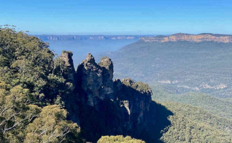
A fairly short but still interesting walk is to hike down the Giants Staircase and its 800 odd steps, then take the Federal Pass track over to the Scenic World Boardwalk, keeping an eye out for lyrebirds along the way. Ascend out of the valley by either the Cable Car or Scenic Railway. Then return along the Prince Henry Cliff Walk to Echo Point, stopping at the lookouts along the way.
Want to see more of the Blue Mountains? Check out this 4-day guided hike with Intrepid
This makes for about a 5km walk that takes about a leisurely 2 1/2 hours. It can be extended by continuing along the cliffs past the Three Sisters to the start of the Federal Pass Track. Alternatively, return via the steep climb up Furber Steps.
Location: Katoomba Falls, Blue Mountains Tourist Park, NSW – see the map
Length: 5km I Difficulty: Moderate
Summiting Mt Kosciuszko (NSW)
While ascending the tallest mountains on most continents involves at least multiple days of hard hiking, if not the risk of death, Australia’s highest peak, Mt Kosciuszko, is only 2228m tall. Until the 1970s, it could be reached by driving to just a few hundred metres from its summit!
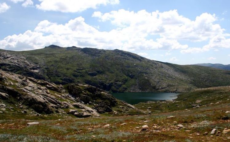
These days it’s necessary to hike, but still not that far. The shortest route to the summit of Mt Kosciuszko is a mere 6.5km along a well-formed track from the chairlift at the top of the Thredbo ski-field. It can easily be done in about 3 hours.
Don’t want to walk alone? A 4 day hiking tour is a fantastic way to experience the Snowy’s
An alternative and more challenging route for hiking Mt Kosciuszko is the Main Range Circuit from Charlotte Pass. Nearly 22km long, this route crosses the Snowy River on stepping stones, then passes by Blue Lake and Carruthers Peak on the way to Kosciuszko, before returning along the old car road. The views of the valleys to the west are simply stunning.
Location: Thredbo, New South Wales – see the map
Length: 6.5km or 22km I Difficulty: Difficult
Dove Lake Circuit at Cradle Mountain (TAS)
Cradle Mountain marks the start of the Overland Track, a six-day trek through the alpine region of Tasmania and one of the best multi-day hikes in Australia. But for those without the determination or the time, there are also many shorter hikes around the Cradle Mountain area, including the Dove Lake Circuit.
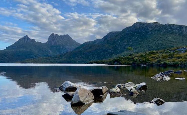
At only 6km long and mainly along boardwalk, it’s an easy walk that’s suitable for the whole family, meaning you can concentrate on the stunning vistas across the lake and up to the peaks rather than your footing. The hike also passes through a beautiful example of temperate forest, known as the Ballroom Forest.
This 1-day tour ex Hobart has 5 hrs at Cradle Mountain which is plenty of time for this hike!
While hiking at Cradle Mountain or anywhere in Tasmania, be prepared for rain. Snow sometimes falls here during the winter months and this walk is even more magical with a dusting of white. Don’t stop there though, there are so many great walks in Tasmania!
Location: Cradle Mountain, Tasmania – see the map
Length: 6km I Difficulty: Moderate
Wineglass Bay to Hazards Beach (TAS)
On the east coast of Tasmania is the beautiful Wineglass Bay, often listed as one of the most beautiful beaches in the world. Not that you can drive to this beach – of course a hike is required to reach it.
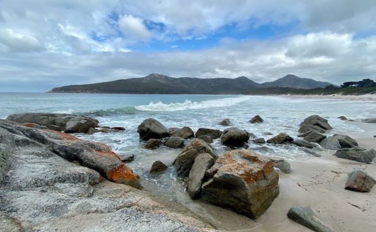
If you’re just after a short (but steep) walk, the most popular options is to ascend from the main car park to the lookout overlooking the stunning bay, then return via the same route. This hike shouldn’t take longer than 1 1/2 hours.
If you don’t have a car join this 1 day hiking tour from Hobart to Wineglass Bay
From the lookout, it’s also possible to continue down to the gorgeous white sands of the beach. You can then return by the way you came, or alternatively skip on the ascent and loop back to the carpark via Hazards Beach, making a 11km loop. Make sure you keep a lookout for the local dolphins and migrating whales off the coastline.
Location: Wineglass Bay Beach, Tasmania – see the Map
Length: 11km (loop) I Difficulty: Easy
Circuit around Uluru (NT)
For many years, the most famous walk to do at Uluru was climbing to the top of the giant monolith. However, after many years of the local Aboriginal population asking visitors not to do this, this climb permanently closed in 2019.

Not that visitors to Uluru are losing out, with the still-open walk around the base of Uluru offering so much more. This flat 10.5km hike provides views of the red rock from many angles, and the chance to view Aboriginal artwork. If you’re lucky, you might even spot a Thorny Devil, a ferocious looking but harmless lizard native to the deserts and scrublands of central Australia.
Join a guided walking tour with transfers and breakfast included
Each morning you can join rangers on a free guided tour of the first section of the walk, starting from the Mala carpark, at 8am (October to April) or 10am (May to September). Don’t also miss heading over to Kata Tjuta and completing the Valley of the Winds Walk; it’s a close toss-up for which is the most spectacular. Check out our guide to walking at Uluru for more tracks to explore.
Location: Petermann, Northern Territory – see the map
Length: 10.5km I Difficulty: Easy to Moderate
See our guide on the best places to stay at Uluru and allow 3 days if you can to really explore the best spots.
Rim Walk at Kings Canyon (NT)
Just over 300km via road from Uluru is located the equally impressive Kings Canyon. With walls stretching over 300m high, the best way to appreciate the canyon is by completing the 6km Rim Walk, another must-do day hike in Australia.
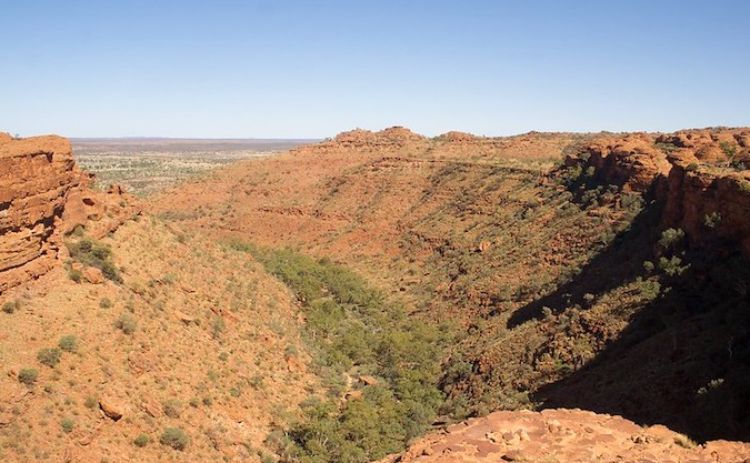
Starting with a strenuous climb up the side of the canyon (it’s all easier going once that’s complete), the walk offers impressive views down into the canyon, plus of the Garden of Eden waterhole, the maze of sandstone domes up on top and the surrounding desert landscape.
This Kings Canyon tour includes transport from Uluru, the Rim Walk and breakfast
On hot days, walkers must start the 3 to 3 1/2 hour walk before 9am, after which the starting point is fenced off. The best time to visit is around sunrise and sunset for the ever-changing colours of the landscape.
Location: Petermann, Northern Territory – see the map
Length: 6km (loop) I Difficulty: Moderate to Difficult
Hiking the Gorges of Karijini (WA)
Located in the iron-ore rich country half way up the Western Australia coast, Karijini is well worth heading out of your way to visit. There’s a variety of hikes of different difficulties in the different gorges, most no more than a couple of hours long.
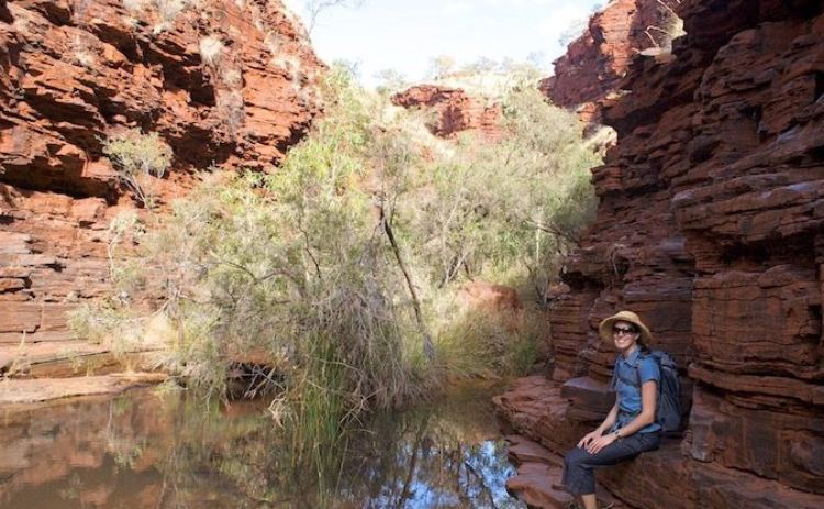
One of the highlights for those up to a challenge is the hike to Kermit Pool in Hancock Gorge. It’s only 400m one-way, but allow at least 1 1/2 hours for the return hike. Be prepared to wade through water (or clamber along the side of the gorge) and then undertake the “Spider Walk”, with one leg balancing on each side of a narrow ledge above a fissure. The spectacular views of the narrow gorge walls and the blue-green waters of the Kermit Pool are well worth it!
Just be warned that most of the pools, including the Kermit Pool, are freezing cold during the winter time, because of the lack of sunlight penetrating the gorges. (Winter is the peak time to visit the park, to avoid the summer heat of 45C plus.) A better alternative is to take the short walk to the gorgeous Fern Pool at Dales Gorge. Its water are pleasantly refreshing, rather than icy cold, and it’s close to a great camp spot.
Location: Karijini, Western Australia – see the map
Length: 400m one-way, with 1.5 hours of return hike
Difficulty: Easy to Moderate
Main Gorge Track at Carnarvon Gorge (QLD)
Located about 400km inland from Rockhampton on the Queensland coast, Carnarvon Gorge is one of the top attractions of Outback Queensland. And one highlight of a visit to this national park and one of the best Australia day hikes is the main gorge walking track.
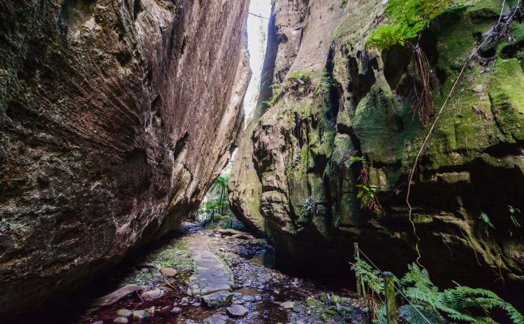
The first section of the multi-day 87km long Carnarvon Great Walk, this track heads 9.7km one-way into the gorge. Along the way there’s a number of side tracks that it’s worth taking, with some of the most impressive sights including the Moss Garden, the 60m deep chamber of the Amphitheatre, Ward’s Canyon, and the impressive Aboriginal rock art at the Art Gallery and Cathedral Cave.
To see all of these, then turn around before reaching the Big Bend, allow a full eight hours for the 22km hike.
Location: Carnarvon Gorge, Queensland – see the map
Length: 9.7km I Difficulty: Easy
Got a question? Head over to our Australia Travel Tips Facebook Group and ask a local.
Author: Shandos Cleaver is the founder of Travelnuity, a travel blog focused on dog-friendly travel around the world. Having lived in Australia for most of her life, she’s hiked countless trails in every state and territory of the country, although she’ll admit it’s best to leave your dog behind to access many of the National Park.

