29 Beautiful Natural Landmarks in Australia
Before you start planning your next trip, we suggest you take a look at this list of top landmarks in Australia. There are so many you could easily build an itinerary visiting these iconic places that could last several months. We have made it to 20 of these ourselves. How many have you ticked off.
Our diverse landscape is full of amazing natural formations and several UNESCO World Heritage sites. To make it easier for you to locate these natural features, we have grouped them by state. We have also included detailed advice on how to reach them.
This post contains affiliate links. Our full disclosure policy is here.
You may also like to check out our must-see stops on a lap of Australia
Natural Landmarks in NSW
NSW may be best known for its iconic man made landmarks of the Sydney Opera House and Sydney Harbour Bridge but there are some great natural landmarks to see when you visit.
Australia Rock – NSW
If you ask Narooma residents, you will learn that the real Australia Rock is not at Uluru, but at the entrance to Wagonga Inlet in Narooma on NSW Far South Coast. The famous rock formation lies adjacent to Wagonga headland and has a large hole in the middle that bears an uncanny resemblance to the continental shape of Australia (minus Tasmania).
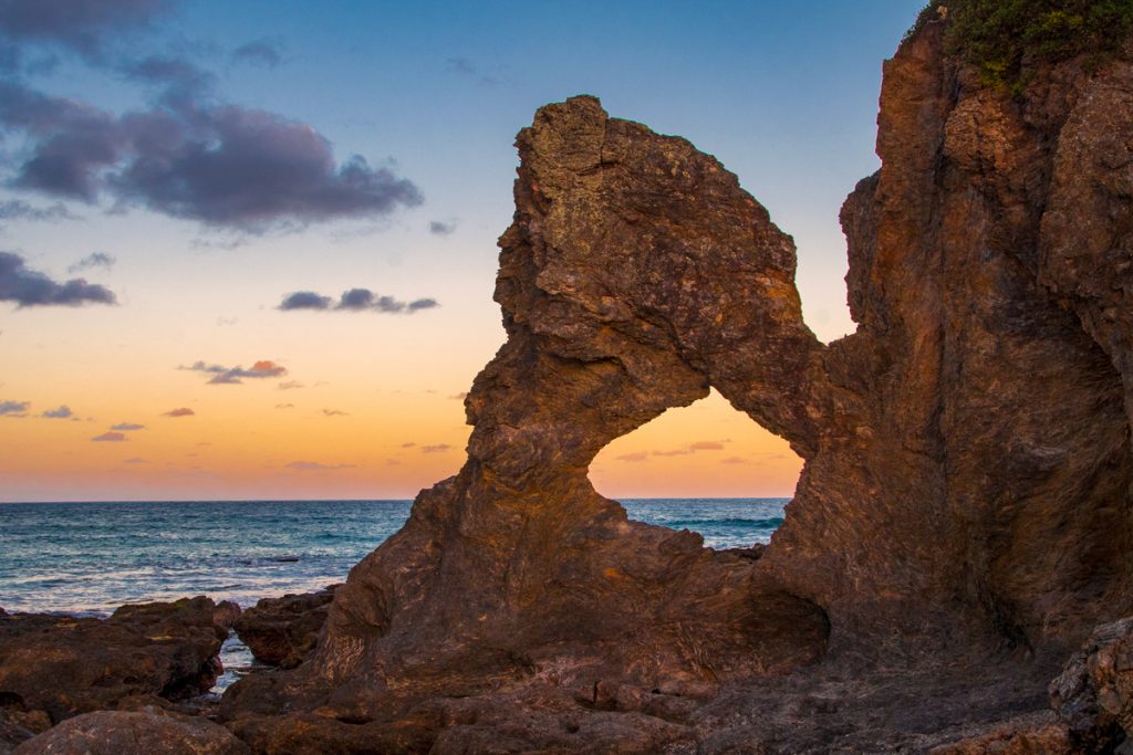
Equally ancient and picturesque, Australia’s rock is a spectacular gem of Australia’s eastern coastline and a must-see sight at Narooma. As you stand at the Bar Rock Lookout (the rock’s official name), gazing through the uniquely shaped hole, keep in mind that the dark rock that makes up this formation was formed on the bottom of the Pacific Ocean 490 million years ago and brought to its present location by the movement of the tectonic plates.
Australia Rock is a dazzling sight at any time of the day, but it is at its best at sunrise and sunset when the sky behind the rock is coloured in multiple shades of crimson and purple and the texture of the rock itself seems to glow.
When you are here, make sure to stroll along the Narooma breakwater wall to check out Australian fur seals camped out on the rocks.
Getting to Australia Rock: To get to Australia Rock, you need to travel to Narooma. It’s a very scenic 5.5hr drive (350km) from Sydney along Princess Hwy or a 3-hr drive (220km) from Canberra along Kings Hwy & Princes Hwy. Once you are in Narooma, reaching Australia Rock is very easy – it is a 10 min walk (or a 2 minute drive) from Narooma public wharf to Bar Rock Lookout.
With its distinctive shape, we are surprised this is not among the best-known natural features of Australia.
Contributed by Margarita Steinhardt from The Wildlife Diaries
Cape Byron – NSW
Located on Australia’s most easterly point, Cape Byron headland offers breathtaking sunrises and all-day views. The point, one of the best-known natural landmarks on the east coast, overlooks the famous surf break, “Tallows” and kilometres of uninterrupted beach, which is also a national park. If you’re there between May and November, it’s one of the best places to watch the whales migrate with offshore displays of jumps and blows.
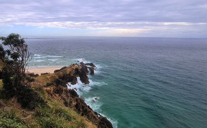
A great insider tip is to make your way to the rock pools at the base of the headland at low tide. These can be accessed by walking around the beach and rocky outcrops from Wategos beach, which is one of the favourite locations for celebrities.
Overall, Byron Bay is a must-do for anyone making their way up or down the east coast of Australia. With stunning beaches, amazing food, and a great “chilled-out” atmosphere, it’s one of the best places to visit in Australia. Get an early start and see the sunrise from this most eastern point in the country.
If you plan to stay a few days you can find some great campsites in Byron.
Getting to Cape Byron: The Cape Byron headland is easily accessible from town (either by walking along the beach/bush trail) or by car (there is a paid parking area next to the lighthouse).
Contributed by Vivien De Greef from The Dharma Trails
Jenolan Caves – NSW
Access to Jenolan Cave is currently closed due to roadworks
Not only is Jenolan Caves one of Australia’s most famous cave systems, at approximately 340 million years old, but it is also the oldest known open cave system in the world. Located in the UNESCO world heritage region of the Greater Blue Mountains, a little over an hour’s drive from Katoomba, the limestone caves are worth the visit.
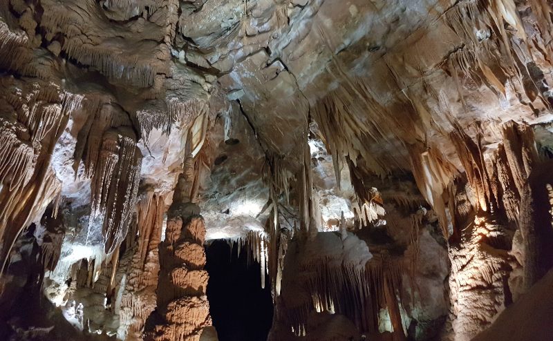
The landscape of the area is exceptional in its own right; plenty of photo opportunities are on offer on the walk down from the car park. There are ten caves through which tours are run, but there is also plenty to see in the open air with several hiking trails and geological formations to admire. Be sure to take a stroll around Blue Lake and keep your eyes peeled – you might be lucky enough to glimpse a platypus!
For those interested in spending a little longer away from the bustle, accommodation is available in the historic Caves House just metres from the caves. Built in 1897, the grand Victorian-style building holds state heritage status and features one of only two remaining grand dining rooms in Australia.Attachments area.
Getting to Jenolan Caves: The cave system is only accessible by road. If you don’t have access to a vehicle, tours can be arranged from both Sydney and Katoomba. Jenolan is located 45 kilometres off the Great Western Highway, the last part of the road is narrow and winding in parts, but the scenery travelling down is picturesque.
Contributed by Holly from Globeblogging
Mungo National Park – NSW
Walking through Mungo National Park is like being on another planet and something you won’t forget. The park is part of the UNESCO World Heritage-listed Willandra Lakes Region.
The park’s central feature is the dry Lake Mungo, which is one of 17 dry lakes in the Willandra UNESCO listing. But the best know site is the stunning landmark known as the “Walls of China”.
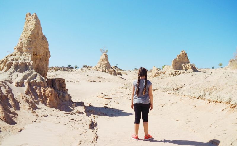
The most significant architectural site in Australia, in 1969, the remains of Mungo Lady, the oldest known human to have been ritually cremated, were both found in the park. Five years later, in 1974, the remains of “Mungo Man” were found, dated more than 20,000 years old when first located; it is now thought they are 28-30,000 years old. They are the oldest human remains discovered in Australia.
You can visit Mungo National Park alone, but the roads are unsealed, so a 4 wheel drive is recommended. Visitors must only walk on boardwalks built over the dunes to protect the environment. Only those accompanied by an Aboriginal guide can go off the official boardwalk. A guided tour is a great option.
Getting to Mungo National Park: Mungo is a long way from anywhere! It is 875km west of Sydney, 110 kilometres (68 mi) northeast of Mildura, and 583km from Melbourne. Most people combine a visit with a stop in Broken Hill or Mildura, or both!
Contributed by Leah Mecki from Kid Bucketlist
If you don’t have transport, you might like to consider a multi-day outback tour
Three Sisters – NSW
The Three Sisters, a rock formation of eroded sandstone, is perhaps one of the best-known landmarks in New South Wales. While many people recognise the Three Sisters, very few know their individual names. The tallest at 922m is Meehni, followed by Wimlah at 918m, and the little sister Gunnedoo coming in at 906m.
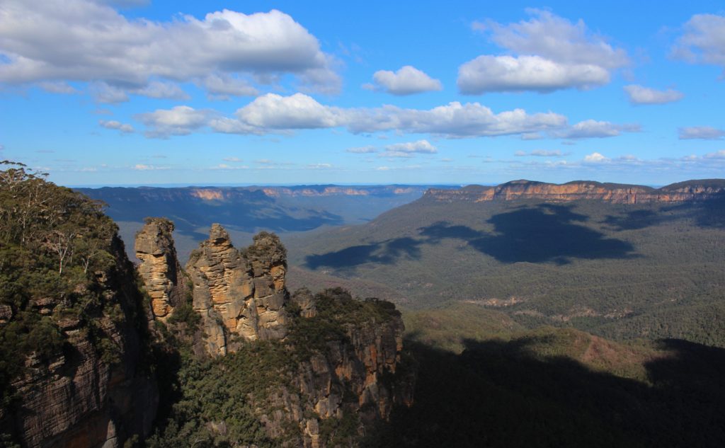
The cliffs of the Jamison Valley formed around 200 million years ago and result from volcanic activity. The area is a spiritual place for Aboriginal groups: the Gundungurra, Darug, Wiradjuri and Tharawal.
There are at least two legends commonly told how the sisters were formed. In the first, they were turned to stone by a witch doctor who did not want them to marry men from a neighbouring tribe. This was discovered to in fact be a story made up to In the other, their father Tyawan turned them to stone to protect them from harm. One legend suggests there was once seven sisters.
You can view the Three Sisters from Echo Point, where there are several lookouts or take a walk right out onto the first of the sisters via Honeymoon Bridge.
Check out how to visit the Blue Mountains easily from Sydney
Getting to the Three Sisters: You can take the train from Central Station in Sydney to Katoomba and then walk 20 minutes or take a local bus to the lookout. Alternatively, it’s a 90-minute drive from the centre of Sydney.
Contributed by Paula from Sydney Expert
Check out our guide to the most beautiful National Parks in Australia for more ideas.
Natural Landmarks in the Northern Territory
Uluru is a must, but there are many more natural features waiting for you in the Northern Territory.
Devils Marbles/Karlu Karlu – Northern Territory
If you ever plan a road trip between Darwin to Alice Springs, you must add Karlu Karlu as an epic place to overnight. Although I highly recommend staying more than just one night as there is lots to do and see in the area.
Karlu Karlu is known for its enormous boulders, bright red from the dirt, that are stacked on top of each other in almost perfect circles. Explore the magic of the place by walking around the base of the boulders. It’s like a natural playground in the middle of the desert!
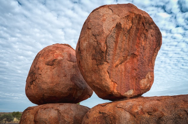
The Devil’s Marbles Conservation Reserve protects one of the oldest Aboriginal religious sites in the world. Several Aboriginal dreaming stories have Karlu Karlu as their setting, which is what makes the site so sacred. One story tells of a Devil Man named Arrange, and you can learn the full story when you visit the site.
To get the best photographs, be there for sunrise or sunset, where the rocks become illuminated in the pinks and oranges of the sky.
Tip: The traditional owners of Karlu Karlu ask that you do not climb on the boulders.
Getting to Karlu Karlu: Karlu Karlu is about four hours’ drive north of Alice Springs and 100km south of Tennant Creek off the Stuart Highway.
Contributed by Crystal Amethyst Egan
Gunlom Falls – Northern Territory
The Top End of Australia is very remote, and many areas require a 4WD to access the best areas. It’s seasonal because of having very distinct wet and dry seasons, and much of Kakadu National Park is only accessible during the dry season between April and September. Gunlom Falls is usually one of the last to open following the wet season and one of the first to close at the commencement of the next wet season. For these reasons, the Gunlom Falls is less of a mainstream Australian attraction.
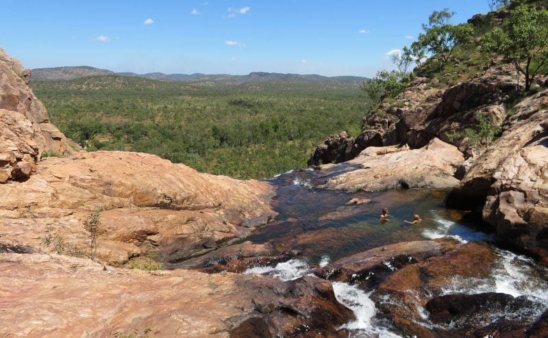
The Gunlom Plunge Pool requires an intense climb on a dirt track with some rock climbing involved at the end. Head up first thing in the morning or after the sun dips in the afternoon, tackling it in the heat of the day should be avoided. Particularly given the dry season will usually see day temperatures above 30 degrees. Heading up first thing means you can spend as long as you like drinking in the breathtaking views.
Getting to Gunlom Falls: Getting to Gunlom Falls requires a 4WD. The area is susceptible to saltwater crocodiles at the water crossings required to get out there. Accommodation options are limited close to Gumlom Falls and to get the best experience I recommend camping at the campgrounds at the foot of the falls. It can be done in a day trip or organised tour; however, it won’t give you the best experience.
Contributed by Sally Lucas from Our 3 Kids v The World who have some great tips on exploring Australia’s top end with kids.
Nitmiluk Gorge – Northern Territory
Nitmiluk Gorge, also known as Katherine Gorge, is a beautiful natural landmark in the Northern Territory. Located 244 kilometres southeast of Darwin and 30 kilometres northeast of Katherine, Nitmiluk Gorge is a must-visit destination in Nitmiluk National Park along with other popular attractions such as Edith Falls and Butterfly Gorge.
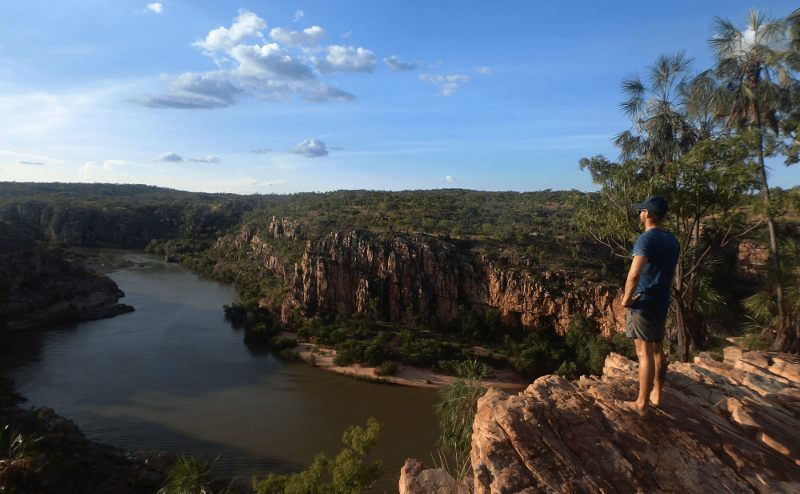
Nitmiluk Gorge is a deep sandstone gorge that was carved by the Katherine River. You can explore the gorge either by boat or canoe on the river itself or by foot from up above. Personally, I recommend doing both! From the boat, your vantage point is completely different from up above.
Boat tours in Nitmiluk Gorge are available daily, and tickets can be bought from an office right at the gorge. In the dry season, you can actually get off at a waterfall on the way back to go for a swim and then walk a short distance back to the tour office. This is the best way to experience all that Nitmiluk Gorge has to offer. It’s an absolutely stunning place!
Getting to Nitmiluk Gorge: It’s a three-hour (310km) drive from Darwin to Katherine Nitmiluk is 30 km northeast of Katherine via a sealed road.
Contributed by Bailey from Destinationless Travel
Kings Canyon – Northern Territory
Kings Canyon is in the Northern Territory and part of Watarrka National Park, which is 450 kilometres from Alice Springs. It has been the home of the Luritja Aboriginal people for over 20,000 years and is a natural landmark to tick off your to-visit list because it is simply stunning. The top activities are hiking, dining under the stars (at Kings Canyon Resort) and flying in a helicopter above Watarrka National Park.
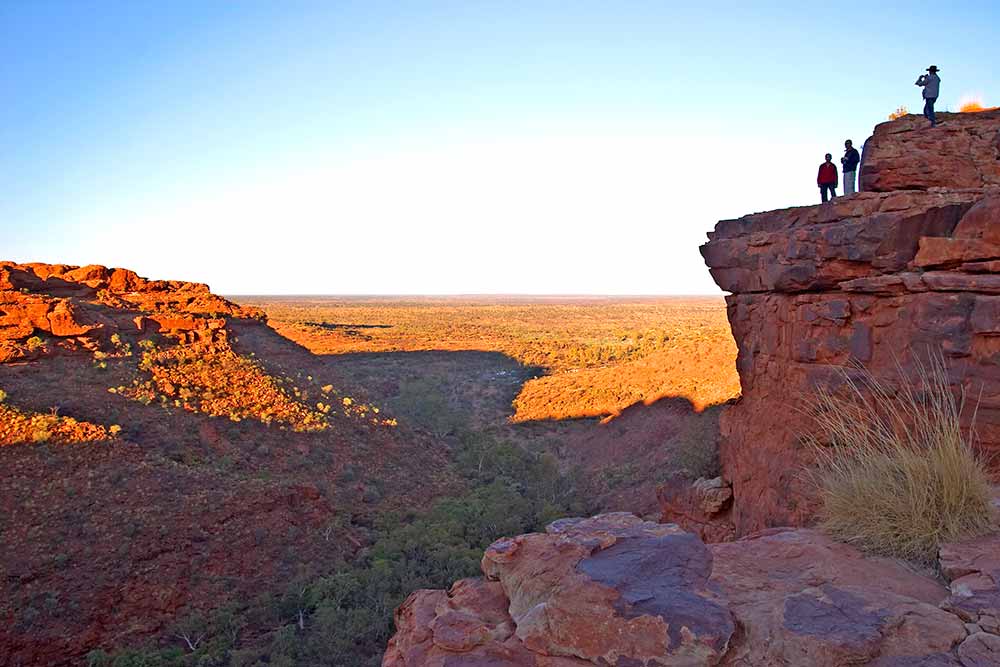
A great way to experience the Kings Canyon Rim Walk, which is a six-kilometre hike that takes about four hours, is to go on an educational tour with an Aboriginal elder. The walk offers stunning gorge views, and along the way, you’ll see Priscilla’s Crack, which was featured in the movie ‘Priscilla Queen of the Desert’ and the mysterious domes of ‘The Lost City’.
The best time of year to hike Kings Canyon is between May and October, as it can get steamy between October and April. Take a tip and start hiking at dawn for a comfortable experience.
Getting to Kings Canyon: The two ways to reach Kings Canyon from Alice Springs are by driving along the Lasseter Highway or the Mereenie Loop road. The latter is a famous 4WD driving route that you’ll have to apply for a permit to drive.
Contributed by Roger from Travel Sassy Seniors
Kata Tjuta – Northern Territory
Almost always combined with a visit to Uluru, be sure to allow at least a couple of hours to explore one or all of the walks at Kata Tjuta. Previously known as the Olgas, Kata Tjuta, the traditional name for the formation, which means “many heads” can be found 25km north of Uluru in the Uluru-Kata Tjuta National Park.
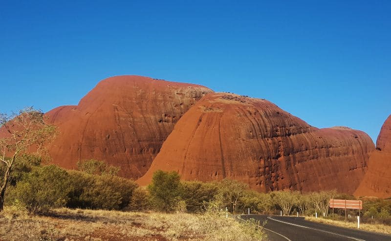
There are two main walking tracks to explore, the Valley of the Winds Walk and the Walpa Gorge Walk. The Valley of the Winds circuit is a 7.4 km, grade 4 walk that should be started early in the day. It takes 3-4 hours and is steep in places with a very uneven path. Best not done in the heat of the day, the walk is officially closed when the temperature reaches 36 degrees celsius.
The Walpa Gorge walk is much easier and only 2.6km, it’s particularly lovely at sunset.
Made up of 36 domes, the official name of these types of formations is bornhardts, and it is a sacred place for the Anangu, local aboriginal people of central Australia.
Getting to Kuta Tjuta: The best way to get there is to fly directly to Ayres Rocks Airport. Yulara is the best base for exploring Kata Tjuta. You will find the Yulara Resort 4hr 40mins (446km) from Alice Springs.
Check out our very detailed guide to all your accommodation choices at Ayres Rock Resort at Uluru.
Contributed by us!
McDonald Ranges – Northern Territory
The MacDonnell Ranges are a spectacular series of mountain ranges in Central Australia. They stretch east and west of Alice Springs; the most popular attractions are in the West MacDonnell Ranges.
Along the 150km of the West MacDonnell Ranges, there are gorges, waterholes, gaps and chasms to explore. Ormiston Gorge, Ellery Creek Big Hole, Standley Chasm, Glenn Helen and Serpentine Gorges are all popular and beautiful sights.
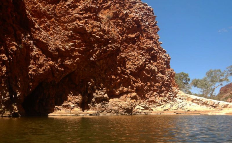
The scenery is incredible. In every direction, there are steep, craggy ranges rising from the red and orange of the desert landscape. The gorges and canyons you can drive and walk through allow you to explore the landscape up close and appreciate its many features.
Our favourite spot is Redbank Gorge at the western end of the West MacDonnell Ranges. Between the towering orange rock, walls are a series of waterholes. We floated through them on a lilo; it was great fun!
You want to avoid the area in summer when the heat makes doing the many walks quite hazardous. April to October offers the best conditions. In winter, it gets below freezing overnight, so even though you are in a desert environment, you will still need some warm clothes.
Getting to the MacDonnell Ranges: Central Australia is a remote location. It’s at least 1500km from any capital city. You can fly to Alice Springs and hire a car which is a popular option for shorter trips to the region. Just know, when you do get there, your effort will be rewarded!
Contributed by Natalie Klein from Curious Campers
Uluru – Northern Territory
There are few Australian landmarks as striking as Uluru, the largest single rock monolith in the world. Standing proudly in the heart of the Australian outback, Uluru has been a spiritual place for local Aboriginal populations for millennia.
The red rock is certainly a sight to behold in itself, especially during sunrise. Still, you can learn more about the area by taking an Aboriginal-led tour that will detail their customs and way of life, and why this rock is so special in native Aboriginal culture.
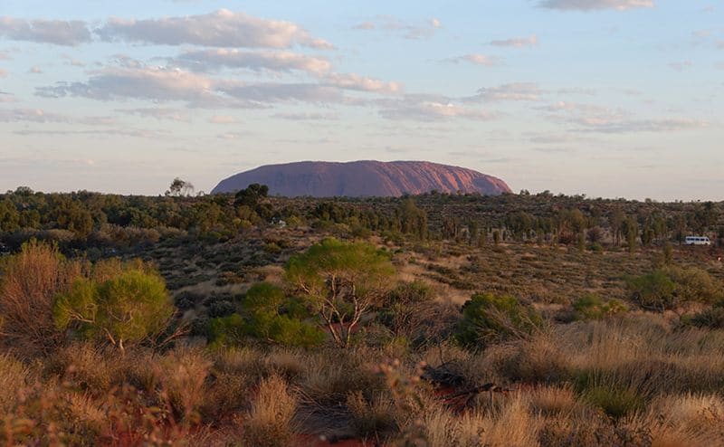
Visiting Uluru in the summer is to be avoided; it can be scorching hot, and there’s little shade, and the trail closes when the heat becomes extreme. Temperatures in Autumn and Spring are warm but manageable, and winter is much more comfortable at night – although if you’re camping, be aware that the nighttime temperatures can plummet to below freezing.
Getting to Uluru: Uluru is located in the southern part of the Northern Territory, not too far from the South Australian border. It’s nearly in the middle of the country – a 20-hour drive from Darwin and a 16-hour drive from Adelaide! Many people visit on an Adelaide to Darwin road trip, but it’s also possible to fly into Ayers Rock Airport or Alice Springs Airport (Alice Springs is about 3 hours away, but flights can be cheaper).
Uluru is a spectacular place to visit and should definitely be included on anyone’s trip to Australia!
Contributed by Claire from Claire’s Footsteps
Natural Landmarks in Queensland
The Great Barrier Reef is one of Australia’s best known natural features, but the sunshine state offers many more landmarks that deserve a spot on your Queensland Itinerary.
Daintree Rainforest – Queensland
One of the highlights of a visit to North Queensland, the Daintree Rainforest north of Cairns, is part of the Wet Tropics of Queensland World Heritage Site, a UNESCO site.
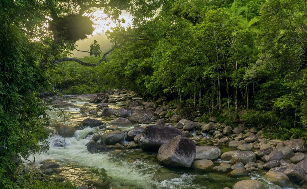
It is thought that the Daintree Rainforest is 135 million years old, older than the Amazon Rainforest. The Kuku Yalanji people have lived in the area for more than 50,000 years. You can learn more about their culture by joining one of their tours.
Getting to the Daintree Rainforest: The Daintree is approximately 125km north of Cairns, about a 2-hour drive. From Port Douglas, the drive takes a little under an hour. If you don’t have a car, there are dozens of tours available from Cairns, Palm Cove, or Port Douglas.
Contributed by Us!
Not sure whether to base yourself in Cairns or Port Douglas for your reef holiday – check here
Great Barrier Reef – Queensland
The Great Barrier Reef is one of Australia’s, and the world’s, most iconic natural landmarks. The world’s largest coral reef system is home to approximately a third of the world’s protected marine life and is composed of over 2,900 individual reefs and can be seen from outer space.
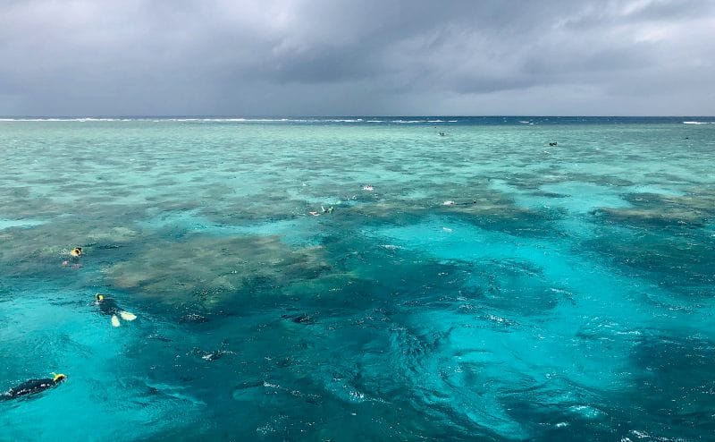
One of the Seven Natural Wonders of the World, the Great Barrier Reef is located in the Coral Sea off the coast of Queensland.
Operators offer day trips to the reef year-round, but the best time to visit is from June to October. At this time of year, there isn’t as much rainfall which means better diving conditions and clearer water. However, you’re guaranteed to have an incredible experience regardless of when you visit.
Insider tip: you don’t need to have prior diving experience to dive the reef. Most of the excursions offer an introductory course, and the instructors on board will be there to hold your hand as you explore the reef.
Even if you’re not a fan of swimming, you can still catch epic views of the marine life from the boat itself without having to get into the water.
Getting to the Great Barrier Reef: There are several entry points for the Barrier Reef due to its size; Cairns, Townsville, and the Whitsunday Islands are all popular bases for visitors to access the reef. From each of these towns, you can take a boat journey out to the reef.
Contributed by Disha Smith from Disha Discovers
Discover more of the region with our Things to do in Townsville
Lake Mackenzie – Queensland
When it comes to natural landmarks, Australia doesn’t come up short. One of these amazing landmarks sits on the beautiful Fraser Island in Queensland, Lake McKenzie.
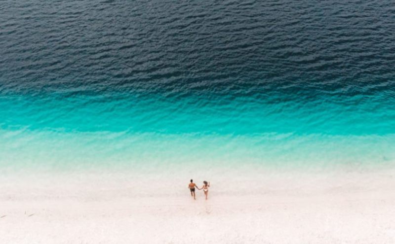
Lake McKenzie is not like any other lake. It is made up of freshwater, pure rainwater. It is so fresh only a few organisms can survive in it. The water is an eye-catching deep blue which gets lighter and brighter the closer to the sand it gets.
The sand at Lake McKenzie is made up of pure silica. This makes it a bright white colour that doesn’t get hot even beneath the unforgiving Australian summer sun.
Once you have topped up on the tan, you can go swimming in the refreshing water which is only one of a handful of places you can safely swim on Fraser Island.
Fraser Island is only explored by four-wheel-drive cars as the whole Island is covered in sand with no roads. If you don’t have one, you can rent one or have access to one as part of a tour. Just make sure you get there before 11 am as that is when it starts to get a bit crowded.
Getting to Lake McKenzie: To get to Lake McKenzie, you must take a boat from the nearby towns of Rainbow Beach or Hervey Bay (River Heads). Hervey Bay is the best spot to depart from, head south to River Heads, and you will find ferries and barges run daily.
Contributed by Martin Wood from Just Go Travelling
Whitehaven Beach – Queensland
Located in the heart of the Whitsunday Islands, between the coast of Queensland and the Great Barrier Reef, Whitehaven Beach is one of the most famous Australian landmarks.
You can opt for a day trip or a multi-day cruise. If you also want to enjoy the aerial views, you can choose to book a helicopter flight with a landing on the beach. Finally, you can also choose to charter a yacht.
The Whitsundays is one of the rare places in the world where you can go bareboating, so if you’ve always dreamt of having your own yacht for a few days, that’s the best place to do so.
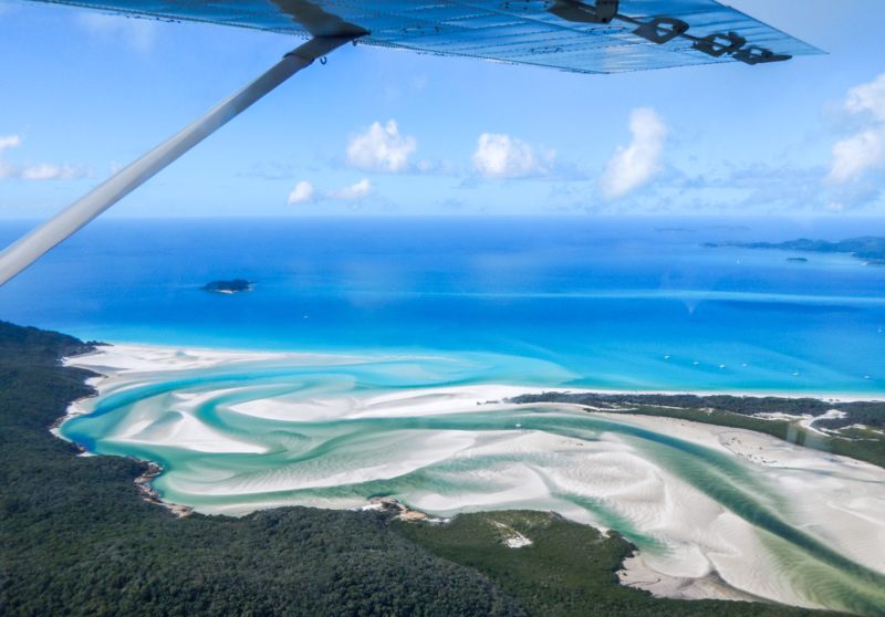
Whitehaven Beach is special for many reasons! The sand is unbelievable, white, and soft. It’s made of 98% of silica!
Although relaxing on the beach is an amazing thing to do, you will need to walk a bit to get to understand why Whitehaven is so magical.
Make sure to go on the bushwalk to Hill Inlet. Once you get to the lookout, you will discover jaw-dropping views of the estuary. The sand and water swirl up, creating this picture-perfect sight! Although the Whitsundays can be visited all year round, it’s better to head there during the dry season.
Getting to Whitehaven Beach: You will first need to make your way to the Whitsundays. There are two airports in the area. One is in Airlie Beach, the nearest coastal town, and the other one on Hamilton Island, Australia’s most popular resort island.
From there, you can easily get to Whitehaven Beach by boat or helicopter. Unfortunately, there is no ferry service going to this specific island; However, you will find a plethora of sailing tours.
Contributed by Pauline Vergnet from BeeLoved City.
Natural Landmarks in South Australia
We were lucky enough to spent 5 weeks road tripping in South Australia recently and were blown away but how much beauty this often forgotten state has within its borders.
Kanku Breakaways Coober Pedy – South Australia
As you stand on the lookout point with the vast expanse of the Kanku Breakaways spreading out into the distance before you, you do two things – marvel at the sheer number of colours you can find in the sandstone mesas that rise from the floor, and wonder what on earth happened to all the fish!
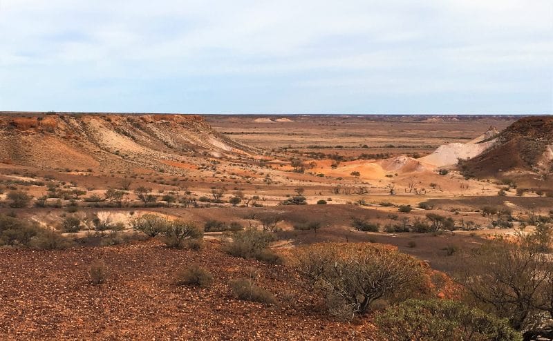
You see, the picturesque rock formations that make up the Kanku Breakaways Conservation Park, just outside Coober Pedy in South Australia, were once covered by a vast inland sea. Over time, the water disappeared, but the mesas created on the sea bed still remain. And they’re beautiful.
Sunset is one of the most spectacular times to see the colours of the rocks change, and many of the hotels in Coober Pedy offer sunset tours for guests. If you do decide to go alone, you’ll need to collect a permit from the Visitors Information Office in Coober Pedy before your trip.
Getting to the Kanku Breakaways: You can visit the park on your own, it’s about a 30-kilometre drive north of Coober Pedy, but it’s better to go on a tour if you can as your guide will point out the spiritual significance – and various film appearances – of the most famous rock formations in the park.
Contributed by Helen from Differentville
Discover the best time to go South Australia and plan your visit with the weather in mind.
Remarkable Rocks Kangaroo Island – South Australia
The magnificent rock formation called the “Remarkable Rocks” is found in Kangaroo Island about 130 miles (210KM) southwest of Adelaide on Australia’s southern coast.
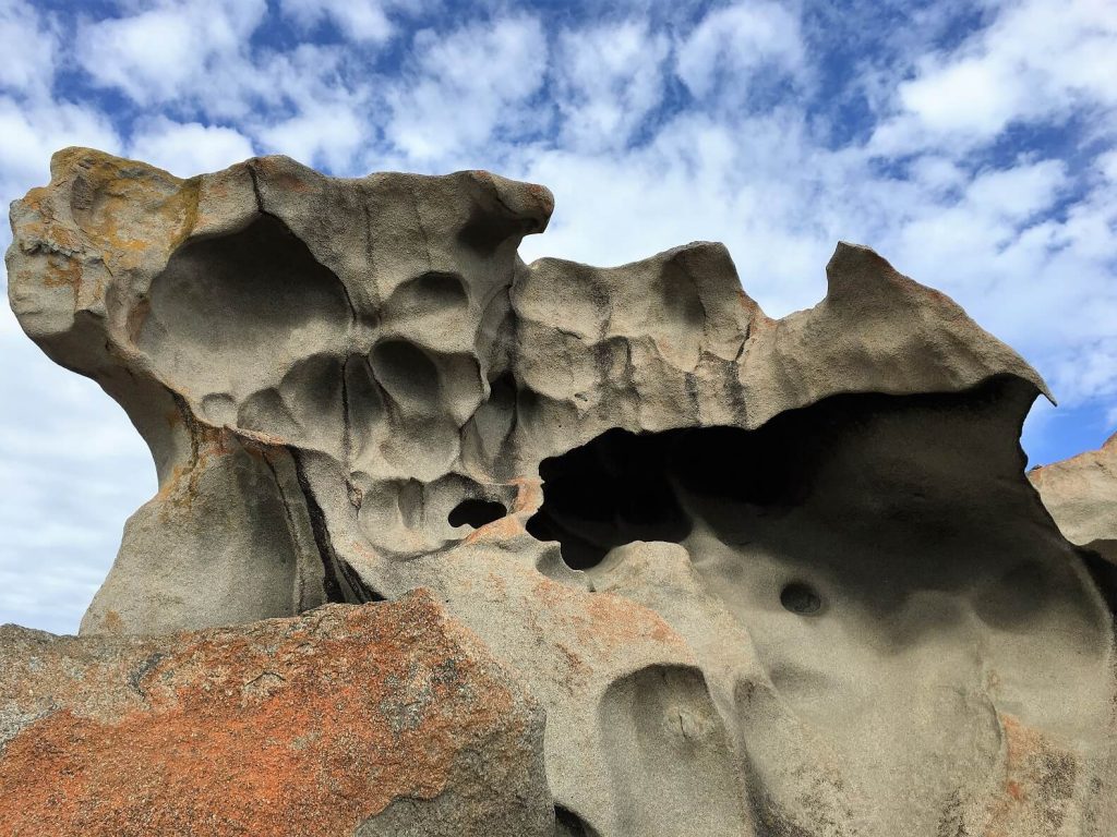
So what’s so fascinating about a bunch of rocks? You have to see them. If Salvadore Dali and Hieronymus Bosch had a love child, it would look like the Remarkable Rocks; bizarre, otherworldly, and magical, the Rocks would make an excellent setting for a sci-fi movie about another planet. Kangaroo Island itself also has many attractions beyond the Rocks.
Getting to Kangaroo Island
There are two ways to get to Kangaroo Island. You can take the Sealink ferry from Adelaide which takes 45 minutes and then rent a car on the island. Sealink also offers bus/coach service from Adelaide with pick-ups at hotels and central points. If you plan to take this trip in one day, be prepared for an early morning pick-up at your hotel. It will be a long day!
You can also fly with REX Regional Express which takes 30 minutes and is much more expensive than the ferry, but you’ll have more time to see everything this interesting island has to offer. Another option is to combine both the ferry ride going and returning to Adelaide by plane. However you get there, it’ll be worth it!
Contributed by Talek Nantes from Travels with Talek
We explored Kangaroo Island for five days and highly recommend it!
Ikara/Wilpena Pound Flinders Ranges – South Australia
Wilpena Pound (also known by its traditional name of Ikara) is an incredible natural amphitheatre located in the Flinders Ranges, about 450km north of Adelaide, South Australia. It is one of the most ancient areas in Australia, with nearby rocks dating back over 500 million years, and has a strong Aboriginal history. That makes it a great place to visit to feel a connection to the land and the past.
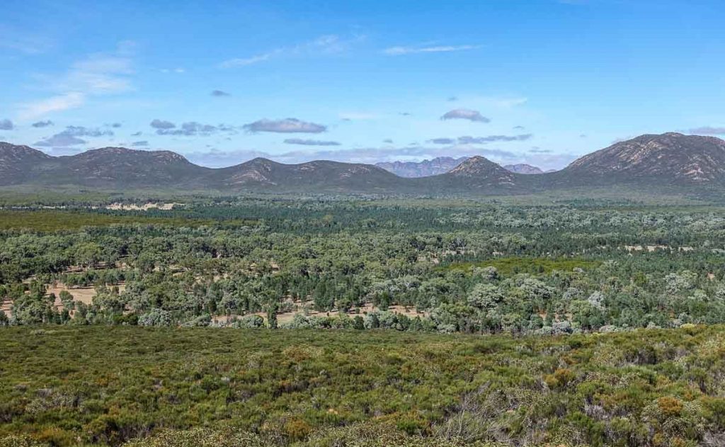
Wilpena Pound is a horseshoe-shaped ring of hills, the highest being St. Mary Peak and deep gorges. Access to the interior is limited mostly to entry on foot as the terrain is rugged. However, around 100 years ago, an intrepid pastoralist built a road and set up a homestead inside the Pound. Today that host is deserted, and Wilpena Pound is part of the Ikara – Flinders Ranges National Park.
The best way to view Wilpena Pound is from the air, and there are plenty of scenic flights available to do that. There are also some great hikes throughout the Pound, including some with Aboriginal guides to teach about the local history and culture.
Getting to Wilpena Pound: This is best done by car. To get to Wilpena Pound Resort, 2WD is all that is required but to venture further afield, a 4WD is recommended. It is better to visit in the cooler months of the year to avoid the oppressive summer heat.
See what we go up to when we spent 3 days at Wilpena Pound last winter
Natural Landmarks in Tasmania
While many refer to Tasmania as the Apple Isle we like to think of it as the walking state. There are so many amazing multi-day walks to do in this Tassy that you could easily spend months exploring our smallest state.
Bay of Fires – Tasmania
On the East Coast of Tasmania, the Bay of Fires is one of the most iconic and striking natural landmarks of the Apple Isle. Stretching 50km from Binalong Bay to Eddystone Point, the Bay of Fires is renowned for its fiery rocks.
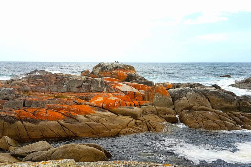
All along the coast, granite boulders are covered in orange lichen, and it’s easy to assume the name Bay of Fires comes from there… But no, the name was given by European explorers in the depiction of the fires lit by Aboriginal people on the coast. This way of controlling the vegetation made hunting easier… Still, the name is very fitting today as the boulders can take a bright fiery colour, very popular with drone photographers.
This part of Tasmania’s East Coast is quite remote and doesn’t have much accommodation or many services.
The most popular spot to view the boulders is at The Gardens, in the Bay of Fires Conservation Area. You can drive all the way to Eddystone Point through an inland unsealed road.
The Bay of Fires is very photogenic and a very nice coastal area, perfect for a swim if the water isn’t too cold. It is worth spending a bit of time in that area, and the best place to stay in Binalong Bay. St Helens is a little further south and has more accommodation options.
Tasmania is beautiful any time of year, even in winter when you have crisp and clear light. Due to its position in the far south, the skies are often heavy with clouds, though. If you are very keen to capture the Bay of Fires’ orange rocks, make sure you pick a sunny day, so the colours are at their best.
Getting to the Bay of Fires: The Bay of Fires is 2hr 30m from Launceston (191.4 km) and 3hr 30m (277.4 km) from Hobart. Day trips for the region depart from both cities.
Contributed by Delphine of Lester Lost
Dove Lake and Cradle Mountain – Tasmania
The rugged West Coast of Tasmania is overflowing with natural beauty and is home to one of the most incredible natural landmarks. Cradle Mountain is located in the north-west corner of Tasmania, 2.5 hours’ drive from Launceston.
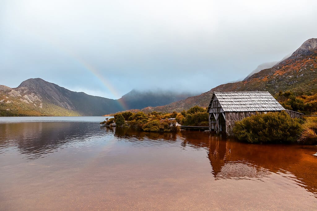
What entices visitors to this area is the pristine beauty, native wildlife, natural diversity, and the many walking tracks, including the legendary Overland Track and the iconic Dove Lake walk. The 6-kilometre Dove Lake loop that takes you around the glacially carved lake and beneath Cradle Mountain is a popular choice if you travel to Tasmania with kids.
A part of Tasmania’s World Heritage Listed area, Cradle Mountain, is magical to visit in any season. Expect to find the mountainsides covered in orange and yellow hues during Autumn and then deep snow in winter, creating a winter wonderland.
As there is no town at Cradle Mountain, you can choose to visit this area by taking a day trip, or my suggestion would be to stay at one of the accommodation options nearby and soak in the stunning surroundings for a couple of days. Peppers at Cradle Mountain is lovely.
Insider Tip: Follow the path clockwise if you plan to walk the full Dove Lake loop. If you have limited time, take a short walk anti-clockwise to the famous boat shed on the lake, or for a bird’s-eye view of the area, visit the Glacier Rock lookout.
Getting to Cradle Mountain: It is 150km or a 2 hr drive from Launceston to Cradle Mountain. Several companies offer day tours. It is a four-hour drive from Hobart, so tours are best done from Launceston if that works for your schedule.
Contributed by Sharee Middleton from Inspire Family Travel
Staying in Hobart? We have written a guide to Hobart Day tours that can help you plan a visit to these spots.
Wineglass Bay – Tasmania
Wineglass Bay is one of Australia’s prettiest natural landmarks, often making its way into the top 10 lists of the most beautiful beaches in the world. While it’s not the easiest landmark to reach, this is in its favour, as the lack of crowds is part of what makes this bay so special.
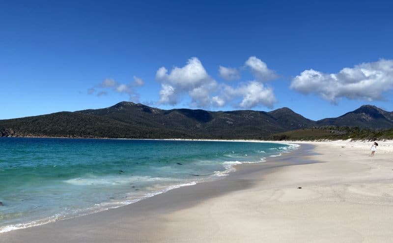
Located on the east coast of Tasmania, Wineglass Bay is located inside Freycinet National Park. To get here, you first need to drive to Coles Bay which is about two hours from Hobart. Once at the national park, there are big car parks to leave your car and the only way to get to the bay is by foot.
The path takes about an hour each way passing through a great lookout over the bay on the way. While the time it takes to walk is not long, the path is steep with many steps, so it’s not an easy walk. However, when you step on the powdery white sand of Wineglass Bay, see the aqua water and enjoy the contrast to the orange coloured rocks, it’ll all be worth it.
It’s worth visiting any time of year although I recommend avoiding rainy or very hot days. The water is at its warmest in Summer and Autumn if you want to swim (but still cold). Visiting later in the afternoon can help avoid crowds but make sure you will be back during daylight hours. Being inside a national park means that you need a Tasmanian national parks pass to visit here.
Getting to Wineglass Bay: It is a 2 hr 20 min drive from Hobart to Coles Bay (184.9 km) or a 2 hour (167.8 km) trip from Launceston. There are day tours from both cities
Contributed by Sharon Gourlay from Tasmania Explorer
Natural Landmarks in Victoria
Victoria punches above its weight when it comes to beauty with the gorgeous Grampians National Park on spot we can’t wait to spend more time in. The state is particular beautiful in the autumn, you can learn more about the best time to visit Victoria here.
Twelve Apostles – Victoria
The Twelve Apostles are one of the most recognisable landmarks in Australia, and one of the most popular stops on any Great Ocean Road itinerary. These huge limestone columns are just off the coast of Port Campbell National Park. Despite the name, there are actually only seven limestone stacks (there used to be eight but one collapsed in 2005).
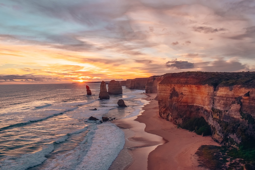
You can easily drive to the Twelve Apostles yourself. There is a huge parking area where you can leave your car, and then from there, walk over to the cliffs and viewing decks. The best time to visit is at sunset. Although it will be the busiest time, watching the sun go down behind these imposing natural formations is a truly breathtaking experience.
Tip: Walk all the way to the final viewing deck, where there are usually fewer people, as well as a great view also on the other side of the coastline. If you’re looking for the most beautiful natural landmarks in Australia, then the Twelve Apostles definitely have to feature on your bucket list.
Getting to the Twelve Apostles: The most direct route takes a little over 2.5 hours (227.4 km), but you really should travel the coast road at least in one direction. This trip takes 4hr (278 km) and is worth every minute. Dozens of tours depart from Melbourne daily.
Contributed by Greta Omoboni from Greta’s Travels
The Great Ocean Road is just one of several great day trips from Melbourne.
Gippsland Lakes – Victoria
Located in the Gippsland Region of eastern Victoria, the Gippsland Lakes are made up of lakes, marshes, and lagoons and cover an area of about 354 square kilometres.
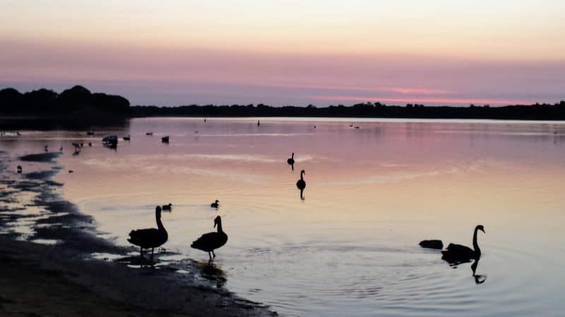
The Gippsland Lakes are a popular destination for day-trippers and holidaymakers from all over the state of Victoria and beyond.
Lakes Entrance is aptly known because it is the only place on the coast that the ocean meets the lake via an entrance. This makes Lakes entrance a hot spot for ocean creatures. You will regularly see seals and Dolphins. The Burrunan Dolphins are not found anywhere else on Earth besides the lakes system of Gippsland.
The Lakes are popular for boating, fishing, and all types of water sports. The other major towns on the lakes system include Metung, Paynesville, and Loch Sport.
The famous Raymond Island Koala walk is easily accessed from Paynesville. The trail allows you to see Koalas in their natural environment. The Gippsland Lakes are a great place to explore for your next trip.
Getting to Gippsland Lakes: Lakes Entrance located 322 kilometres east of Melbourne is the largest town on the Gippsland Lakes. The 90 Mile Beach runs parallel to the lakes system allowing you to access both the lakes and the ocean.
Contributed by Mark Wyld from Travels in Gippsland
Wilson’s Prom – Victoria
Wilsons Promontory or Wilsons Prom as it is affectionately known is located roughly 3 hours from Melbourne, and it is a stunning piece of this planet.
Being the Southernmost tip of mainland Australia, you will find immaculate beaches and majestic Australian bush all mixed into one. Many people come here to camp for a weekend, hike alongside the granite mountains or along the beaches in one of the most gorgeous National Parks in Victoria.
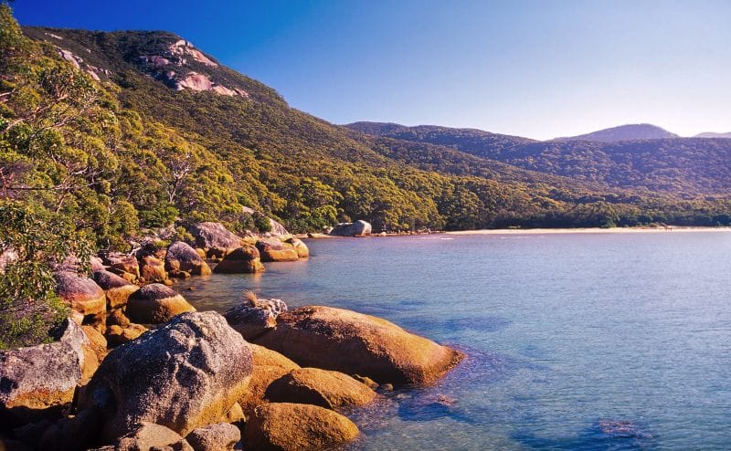
While camping is popular at Wilsons Prom and the surrounding areas like Yanakie, Shallow Inlet. Walkerville and Tidal River, there are plenty of other accommodation options available.
Hiking and fishing are some of the most popular activities at the Prom for people visiting. There are plenty of hikes on offer, from short walks to multi-day hikes that you can do there.
Fishing can be enjoyed offshore or from one of the inlets that Wilson’s Prom is known for. Swimming is also a great activity in summer as there are nice calm sections that are good for any level swimmer.
The Prom is also home to an abundance of Australian wildlife. From kangaroos to echidnas as you wander the landscape, you may be lucky enough to come across one. The wildflowers are also a beautiful sight to see when they are in bloom. Sealife and birds also call Wilson’s Prom home.
While spring and summer are the optimal times to visit Wilson’s Promontory, campsites, and any other accommodation fill up fast, many people visit in winter to escape the crowds.
It doesn’t matter when you visit Wilson’s Prom you will be in for a treat at one of the most beautiful places in Gippsland to visit. It will steal a piece of your heart and will have you returning time and again to discover more of what it has to offer.
Getting to Wilsons Promontory: Just under 4 hours drive from Melbourne (239.0 km) you will need a car to explore the area.
Contributed by Bec Wyld from Wyld Family Travel
If you are heading to Victoria, don’t miss these small towns
Natural Landmarks in Western Australia
Western Australia is home to several Australian natural landmarks – today we share a few, but we are certain you will find many more as you explore the state.
Bungle Bungles – Western Australia
The Bungle Bungle Range is a stunning World Heritage-listed natural landmark in Purnululu National Park. This icon of Western Australia’s Kimberley region is instantly recognisable for its unique ‘beehive’ domes and is a treasure to explore both from the air and on foot.
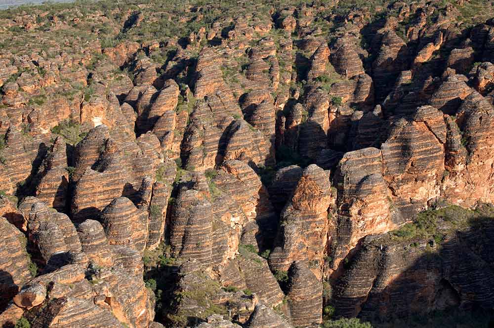
Purnululu National Park is remote, and getting there takes a bit of planning if you are on a road trip. The closest towns are Kununurra, which is 250km away, and Halls Creek is 108km. Another way to see the Bungle Bungles is to take a scenic flight from Broome, with the option to land in Purnululu National Park and spend a few hours hiking to Cathedral Gorge.
The best time to explore the Bungle Bungles on foot is from May to August as the national park is closed from October to March (although you can fly over it).
From Echidna Chasm to Cathedral Gorge, the Bungle Bungles’ stunning gorges and narrow chasms are delightful to explore. There’s a range of walking trails to suit most fitness levels, and you might be lucky enough to see native wildlife like short-eared rock wallabies along the way. The ancestral home of the Djaru and Gija Aboriginal people is truly a spectacular West Australian landmark you must see.
Getting to Purnululu National Park: The nearest capital city to the Bungle Bungles is Darwin, which is a 12hr and 1,118 km drive. Broome is approx. 9hr or 834 km drive away.
Contributed by Christina Pfeiffer from Travel2Next
Elephant Rocks – Western Australia
Elephant Rocks is a formation on the Southern Coast of Western Australia. It is part of the Williams Bay National Park 15km from the small southwest town of Denmark.
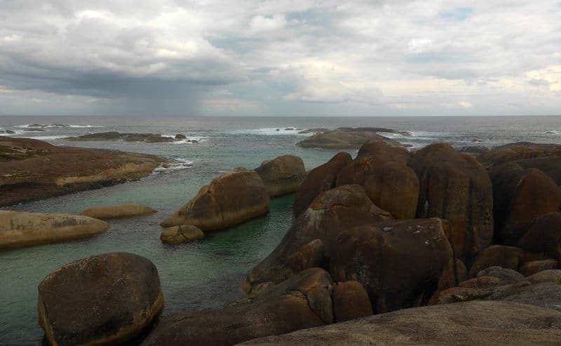
These granite boulders resemble a herd of elephants in the cold, shallow water of the Great Southern Ocean. Signs at the site say that this area is thought to have been a sacred birthing spot for aboriginal women. We certainly felt something extraordinary while we were there.
Be very careful if you head down between the rocks; the sea here can be unpredictable with large waves at times. We suggest heading to the adjacent Greens Pool beach where you can swim safely. You can read more about our day at Elephant Rocks if you are planning a visit.
Getting to William Bay National Park: Just 70km west of Albany, the drive will take you approximately 1 hour.
Contributed by Us!
The Gap and Natural Bridge – Western Australia
The Vancouver Peninsula, just to the south of Albany on Western Australia’s southern coast is home to some of the country’s most diverse landscapes and wildlife. The Gondwana split some 45 million years ago left this stretch of Australian coast with some sheer and dramatic granite cliff faces, which now draw visitors in droves to this incredible and otherwise remote stretch of coast.
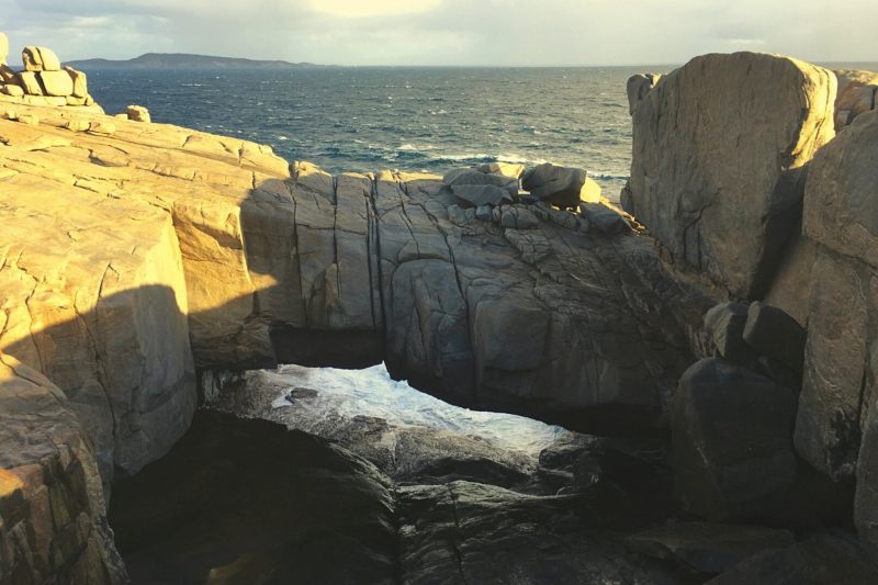
The two most famous rock formations are The Natural Bridge and The Gap, found within Torndirrup National Park. As the name might suggest, the Natural Bridge is a rock formation that has stood the test of time, and despite the powerful Southern Ocean waves pounding the rocks for years, it has yet to collapse.
Nearby The Gap is a 24-metre sheer drop. A large cavern between the rocks has formed over millions of years, allowing the water to creep inside and then dramatically crash, an astounding audio and visual effect that utterly delights onlookers.
For obvious safety reasons, you can no longer climb over the Natural Bridge, and new lookouts have now been created at both of these attractions for much safer public viewing. There are several other nature walks and dramatic beaches in the area for visitors to enjoy. Do expect to get exceptionally wet still and hold on to everything against the wind if you want to admire the sheer power of the Southern Ocean at its best.
You’ll find the best weather (and therefore crowds) in the warm summer months when the oceans are generally calm, but we love to visit in the winter when the sky is broody, and the swells are at their best for the most dramatic experience.
Getting to Natural Bridge: You will need your own set of wheels to get there, approximately 25 minutes from Albany, and a National Park entry fee is payable in the car park.
Contributed by Keri Hedrick from OurGlobetrotters.com
The Pinnacles – Western Australia
A two-hour drive north of Perth will bring you to the spectacular landscape of the Pinnacles Desert in Nambung National Park. Thousands of limestone formations rise from the yellow earth creating a unique and otherworldly sight. Some of the pillars reach as high as 3.5 metres!
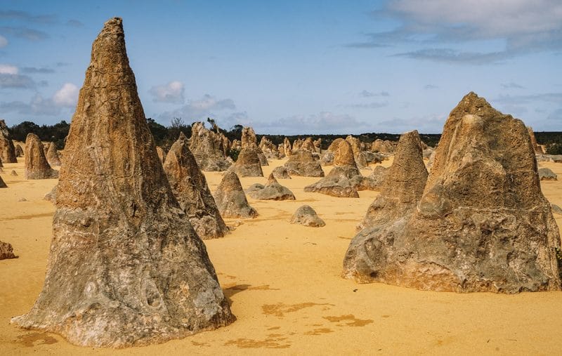
Take a walk through the desert where you can get up close to the Pinnacles. Make sure to stop at the lookout where you’ll find a fantastic panoramic view over the desert with the Indian Ocean as the backdrop. Another option is to drive the loop that runs through the Pinnacles, with plenty of spots to pull over.
Before you leave the national park, make sure to visit the Pinnacles Desert Discovery Centre to learn more about these unique Australian landmarks. You’ll find informative displays explaining the formation process of the Pinnacles as well as facts about the wildlife in the area. Visiting the Pinnacles makes a perfect day trip from Perth but can also be easily included on a road trip along the west coast.
Getting to the Pinnacles: Just 2 hours’ drive north of Perth, it is easy to visit on a day trip.
Contributed by Ann Kelly from The Road Is Life
We hope you enjoyed discovering more about the natural landmarks Australia has to offer and you can add a few of these to your next road trip.
Got a question? Head over to our Australia Travel Tips Facebook Group and ask a local.

Thanks Alison, Ten is a great start. We have only briefly explored South Australia so it’s top of our list for 2021.