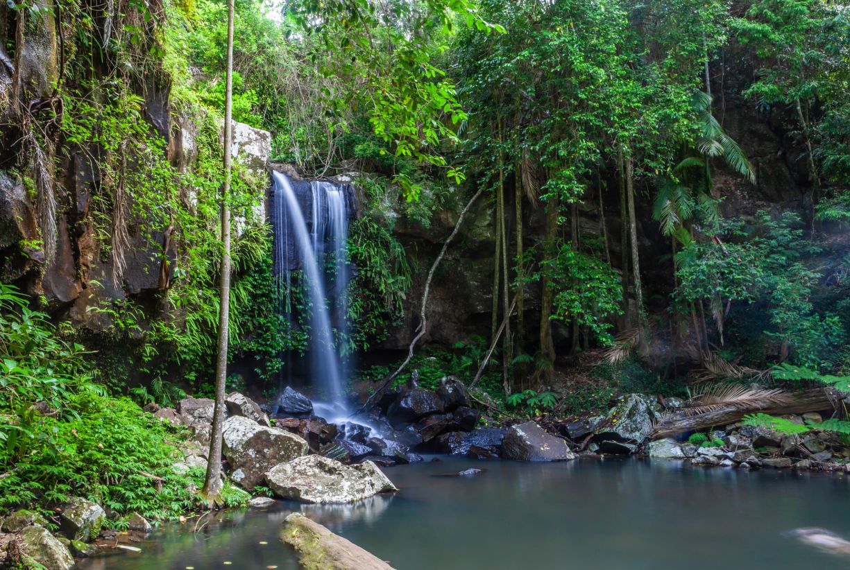
You don’t need to travel far to find stunning waterfalls on the Gold Coast. Within an hour’s drive of the famous Gold Coast Beaches is the lush Gold Coast Hinterland -“the green behind the gold”. I think it’s totally worth leaving the sandy shores for a day to explore them, and discover their secret swimming holes and crystal clear water. Below I have shared all my top tips to plan a perfect day chasing waterfalls in South Eastern Queensland.
This post contains affiliate links. Our full disclosure policy is here.
When is the best time to visit the Gold Coast Waterfalls
Although the waterfalls mentioned here run permanently year round, the best time to visit is during the wet season or after recent rainfall. In South East Queensland, the wet season is from December to March.
Springbrook National Park
Springbrook National Park is part of Australia’s world heritage-listed Gondwana Rainforest areas. Just a 40-kilometre drive from the coast (or 105 kilometres from Brisbane), it’s brimming with spectacular waterfalls, lush rainforest, ancient trees, and exceptional ecological importance.
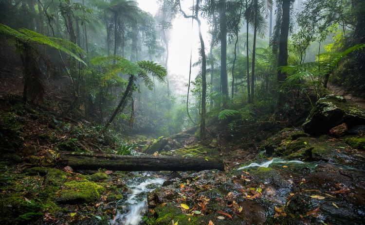
The park contains four sections on and around the Springbrook Plateau.
- The Springbrook section that extends along the crest of the plateau;
- Mount Cougal in Currumbin Valley to the south-east; and
- Natural Bridge and Numinbah Valley to the west.
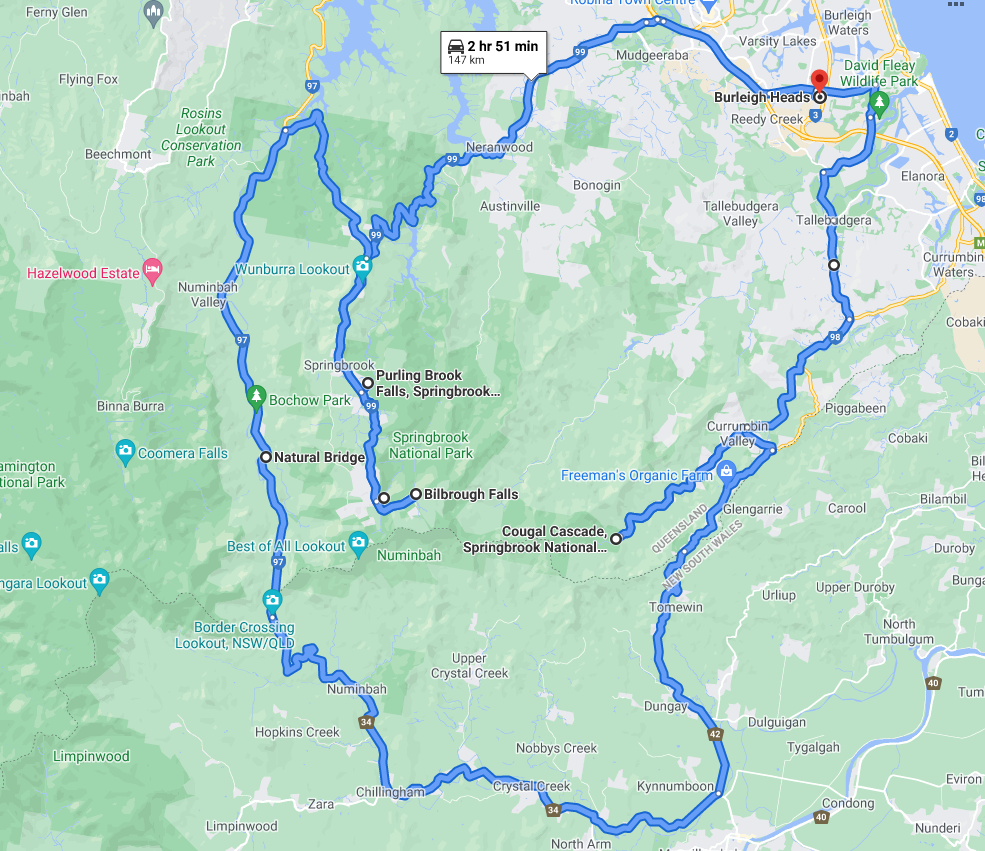
You could visit these in a one-day trip from the Gold Coast either in a circuit drive like the one here or just pick a couple and perhaps take one of the walks.
Springbrook Waterfalls Map
Twin Falls
Twin Falls Springbrook National Park comprises two falls cascading down into three different rock pools. Make your way to Canyon Lookout, it’s the best place to view Twin Falls, as you can see the sheer walls of the canyon beneath, and the ocean beyond.
This viewing platform is very close to the car park and is the starting point for the 4-kilometre track of Twin Falls Circuit.
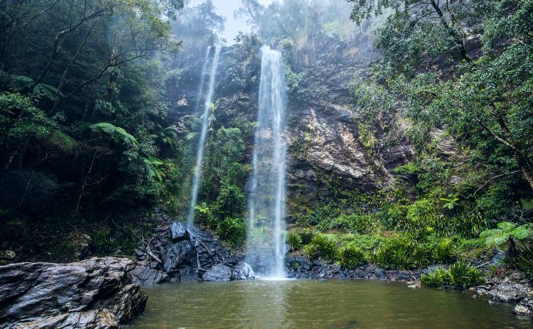
The walk to the falls will take you across streams, through rock clefts and subtropical rainforest. You can walk behind two cascading waterfalls when you reach the forest floor. The perfect spot to cool off in the rock pool on a hot summer day.
Afterwards, grab a cold drink and a snack amongst the beautiful birds in the gardens of Rosellas At Springbrook cafe. The cafe is located directly across from Canyon Lookout at Twin Falls, Springbrook National Park. If anyone in your group is not up for the walk leave them here with a coffee!
Where: 40-kilometre drive from the Gold Coast on Springbrook Road or 105-kilometres from Brisbane.
Difficulty: Moderate. The track has some rough surfaces, steep sections and steps on descent and ascent.
Road access: Car parking available at Canyon Lookout off Springbrook Road
Purling Brook Falls
The 100-metre high Purling Brook Falls Springbrook National Park plunges with a massive torrent of water into the deep canyon below. This horsetail type fall is known as the jewel of Springbrook National Park.
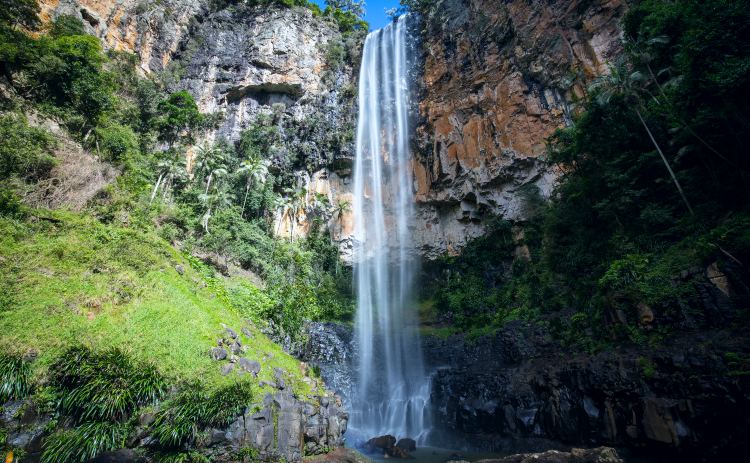
Depending on your fitness level, you can take in the view from above or continue along one of the three walking trails.
The walks take you through dense, lush rainforest vegetation with a couple of viewing platforms along the way to see the magnificent falls.
Please stay on the track, the cliffs have sheer drops and while its tempting to leave over sometimes for a closer look the warnings are real so please take care and keep a close eye on kids.
I think the hike to the base of the falls is worth all the hard work. Looking up at the sheer cliffs of these towering falls is awe inducing. There is also a suspension bridge across Purling Brook with surrounding lush green tree ferns. It’s a favourite spot of photographers.
Where: 40-kilometre drive from the Gold Coast on Springbrook Road or 105-kilometres from Brisbane.
Difficulty: Easy to moderate, there is a short walk of 100-metres to the lookout to observe the waterfall, a more challenging 4-kilometre circuit hike, or the 6-kilometre Warringa Pool hike. There are some sections of stairs.
Road access: Two car parks are available to access Purling Brook Falls. The Main Car Park at the end of Forestry Road, or if that’s full the Settlement Day Use Area at 35 Carricks Road.
Natural Bridge
I visited Natural Bridge on my first trip to the Gold Coast 30 years ago, it’s been a major tourist attraction in the beautiful Numinbah Valley in Springbrook National Park for decades.
This is a great walk for the whole family. The 1-kilometre creek circuit walking path takes you from the car park weaving through the rainforest, across Caves Creek to Natural Bridge. Further down the creek, there are some accessible swimming holes where you can cool off.
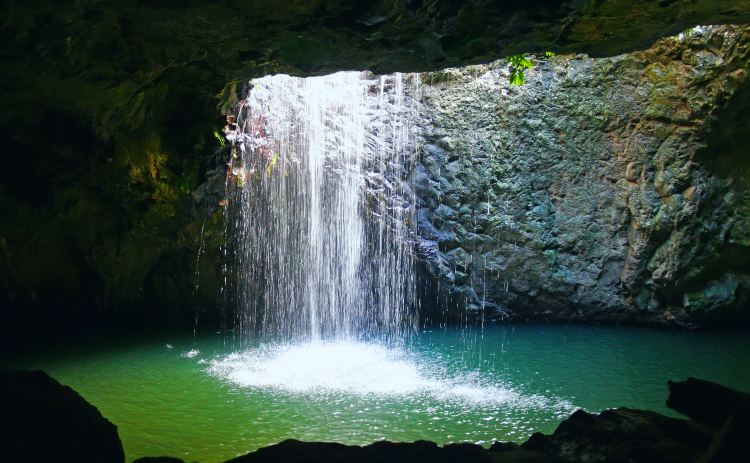
The unique Natural Bridge is an arched cave with a waterfall dropping through the rock face from above into a large rock pool. The cool thing about the cave is that at night the cave is illuminated by thousands of glow worms tiny green lights.
It used to be a busy swimming hole; however, these days, this natural rock pool has been barricaded off to potential thrill-seekers.
Where: 45-kilometre drive from the Gold Coast or 105-kilometres from Brisbane on Nerang-Murwillumbah Road.
Difficulty: Easy. The circuit track is sealed and is a relatively easy walk for all fitness levels, although there is a long section of steps.
Road access: Directly off Nerang-Murwillumbah Road, there is a car park and parking on the roadside.
Goomoolahra or Bilbrough Falls
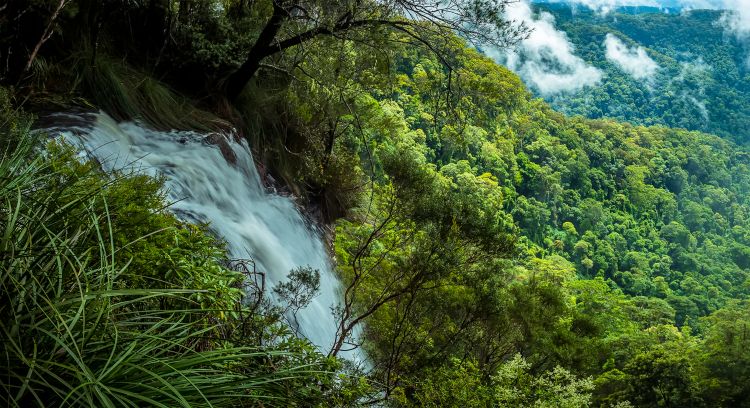
Goomoolahara or Bilbrough Falls drops from a mountain stream over a cliff face, cascading to the valley below.
The beauty of Goomoolahra Falls is that you can picnic here and take in the stunning views of the falls, the Warrie Circuit track below and views of the Springbrook Pinnacle out to the Gold Coast Hinterland.
Where: 40-kilometre drive from the Gold Coast on Springbrook Road (or 105-kilometres from Brisbane).
Difficulty: Easy and wheelchair friendly. Extremely easy to get to, being a short 100-metre walk along a sealed path.
Road access: Car parking is available at the end of Springbrook Road.
Cougal Cascades
Cougal Cascades also in Springbrook National Park is another beautiful spot in the Mount Cougal section in the gorgeous Currumbin Valley.
Cougal Cascades plunge spectacularly down a cliff face into a large pool below. You can see this waterfall from the viewing platform adjacent to the cascades. This accessible, easy riverside walk traces Currumbin Creek terminating at an old sawmill.
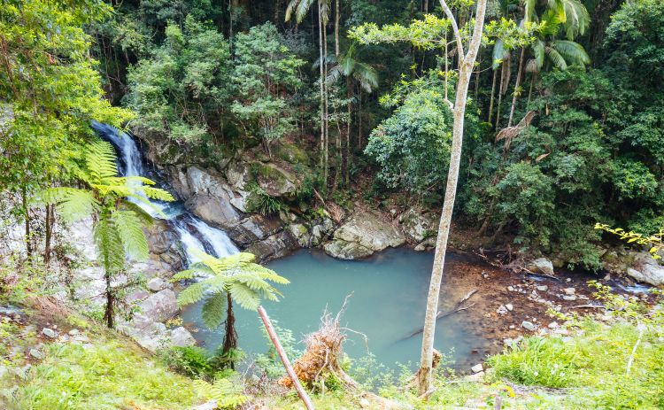
If you feel like cooling off, there are plenty of rock pools along the creek accessible for swimming in the refreshing waters.
Tip: A small picnic area is located adjacent to the car park beside the walking track entrance.
Where: Drive 15-kilometres along Currumbin Creek Road, Currumbin Valley on the Gold Coast to the very end.
Difficulty: Easy and wheelchair friendly. This walking track is bitumen paved and is 1.6 kilometres return.
Road access: Car parking is available right near the entrance to the walking trail.
Lamington National Park
Lying on the McPherson Ranges plateau in the Green Mountains, almost at the New South Wales and Queensland border, you will find Lamington National Park. It is located 46-kilometres from the Gold Coast or 109-kilometres from Brisbane.
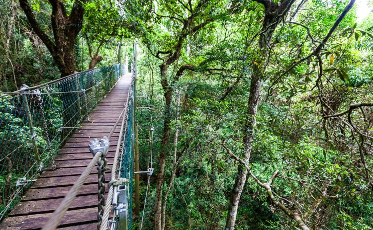
This untouched rainforest national park is exquisite. There are plenty of opportunities for bushwalking, birdwatching and soaking up stunning mountain scenery. With over 320- kilometres of walking tracks that lead to spectacular lookouts, waterfalls and wilderness areas you could easily spend several holidays here!
It is also home to the iconic O’Reilly’s Rainforest Retreat that opened its doors to guests in 1926, and where my parents spent their honeymoon!
Lamington National Park Waterfalls Map
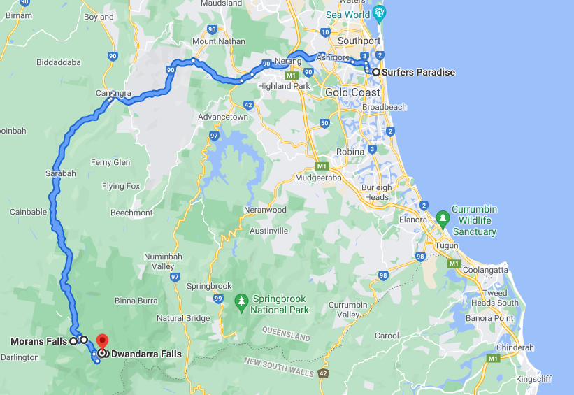
Coomera Falls
Coomera Falls is a segmented waterfall accessed off the Border Track, 1.9-kilometres from the Binna Burra trailhead. The walking track to the falls passes through subtropical rainforests and under giant trees and is challenging. So it is not one to take on unless you have the entire day to do it.
Hike up to the spectacular cantilevered Coomera Falls lookout situated 5.5-kilometres from the trailhead. From the lookout, you will witness the power of the Coomera River as it cascades over Coomera Falls into the 160 metre deep Coomera Gorge below.
Where: Binna Burra off Beechmont Road – a 46-kilometre drive from the Gold Coast or 106-kilometres from Brisbane.
Difficulty: Hard. It is a challenging circuit hike that is 17.4-kilometres in length.
Road access: Car parking is available at Binna Burra.
Elabana Falls
Commencing from O’Reillys Rainforest Retreat, Elabana Falls is, in effect, one of the four waterfalls you will see along the Box Forest Circuit. Elabana Falls, Boxlog Falls, Darragumai Falls and Nugurin Falls are all found along this 10.9-kilometre circuit hike.
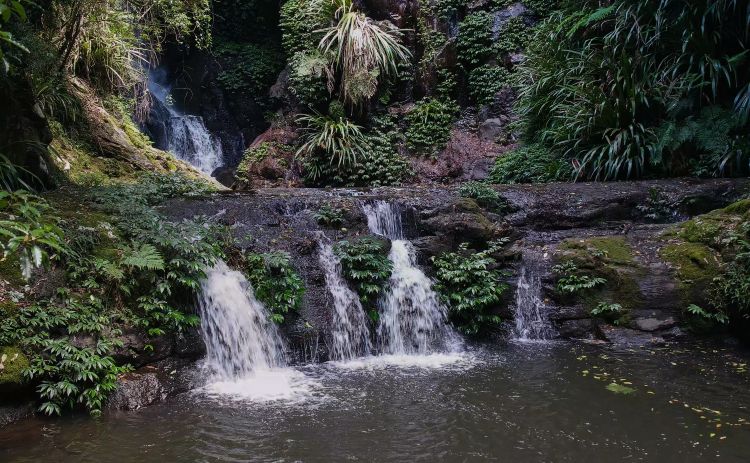
Elabana is probably the most spectacular waterfall of the four. It consists of a 25-metre upper horsetail-type fall and a lower cascade. It is a permanent waterfall with the best time to visit following decent rainfall or from January to March.
Tip: During the summer months, enjoy a swim in Picnic Rock waterhole right near Elabana Falls Lamington National Park.
Where: 46 kilometres from the Gold Coast or 109 kilometres from Brisbane via Lamington National Park Road.
Difficulty: Hard. The hike to Elabana Falls will take you approximately 4 hours to complete on a mostly rough-surfaced track.
Road access: Car parking is available at O’Reillys Rainforest Retreat with access to the trailhead.
Stairway Falls
For experienced hikers, one of the most challenging waterfalls to access, is Stairway Falls Lamington National Park. These are accessible near O’Reillys Rainforest Retreat off the Yerralahla Track.
The falls and sequence of swimming holes are located on West Canungra Creek. There are various swimming holes and rock pools of Stairway Falls some offer “spa” baths, jumps and slides for a fun-filled day of swimming.
Follow the signs to Blue Pool on the Yerralahla Track, and once you reach the pool, head downstream instead of following the remainder of the track. You will eventually reach Stairway Falls after about an hour’s walk of rock hopping.
Tip: Stairway Falls is a full-day trip that will take 2 to 3 hours to hike into the falls and then allow enough time to swim and enjoy these pretty waterfalls and swimming holes.
Where: 46-kilometres from the Gold Coast or 109-kilometres from Brisbane via Lamington National Park Road.
Difficulty: Hard. Experienced hikers only. The hike to Stairway Falls involves a lot of rock hopping and creek crossings.
Road access: Car parking is available at O’Reillys Rainforest Retreat with access to the trailhead.
Morans Falls
The most accessible and easiest to reach falls in Lamington National Park is Morans Falls. There is a choice of two different entry points to access Moran Falls. The first begins at Python Rock (about 1 kilometre before O’Reilly’s Rainforest Retreat), and the other trailhead is located near the main parking lot at O’Reilly’s Mountain Cafe.
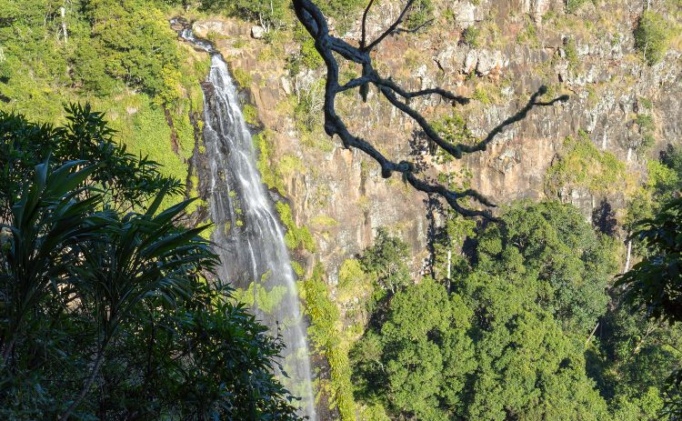
The lookout near the end of the track provides spectacular views of the 80-metre falls, Morans Creek and the Albert River valley. Make sure you go to the top of the falls to check out the site of the original O’Reilly’s home, which was built in 1912. Here you will also find a picnic area.
Tip: Morans Falls is the perfect place to watch the sunset.
Where: 46-kilometres from the Gold Coast or 109-kilometres from Brisbane via Lamington National Park Road.
Difficulty: Moderate. Morans Falls walk is a return journey of about 6.2-kilometres on a combination of bitumen pathways and dirt trails.
Road access: Car parking is available at O’Reillys Rainforest Retreat or Python Rock.
Tamborine Mountain
Some of the best waterfalls near Brisbane in South East Queensland are found on Tamborine Mountain within Tamborine National Park.
Only 72-kilometres south of Brisbane or 40-kilometres from the Gold Coast, Tamborine Mountain is a world away with its distinctive East European flair. You can easily combine waterfalls with breweries and distilleries on this day out!
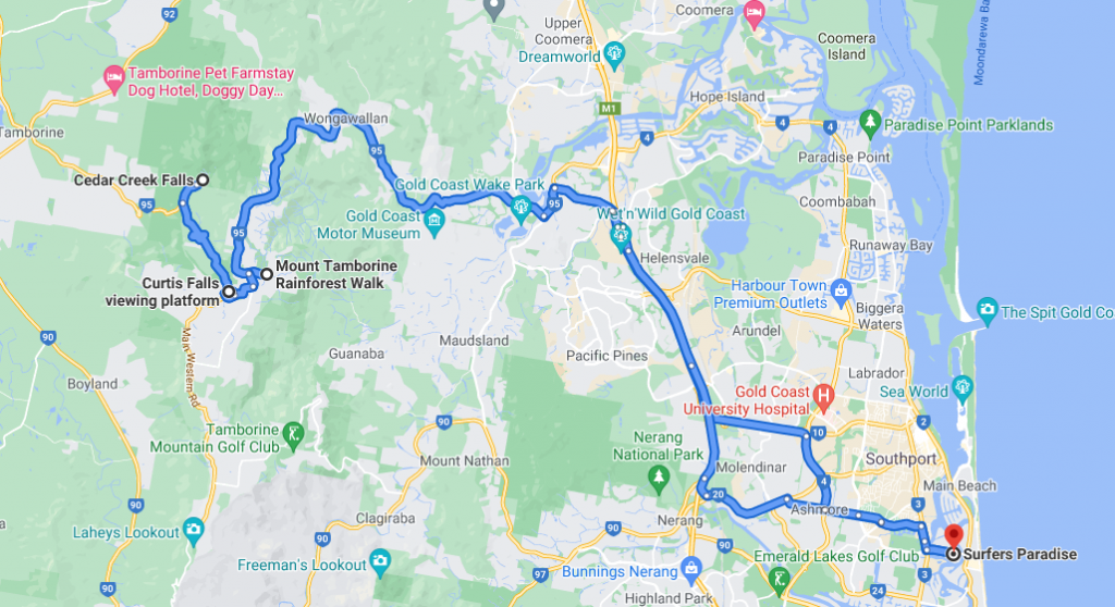
Tamborine Mountain Waterfall Map
Curtis Falls
Located in the Joalah section of Tamborine National Park, is the pretty Curtis Falls. This 12m tall falls are regarded as one of the most beautiful waterfalls near Brisbane and the Gold Coast.
For the best views of the waterfall, head to the large decked viewing platform in front of the falls.
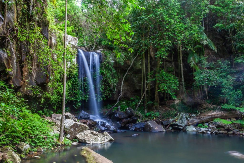
The hike to the falls takes you through a unique rainforest featuring towering gums and dense ferns. Make sure you visit the falls following recent rainfall or they may be a little disappointing. Perhaps check Google reviews for the most recent conditions before you head out.
Although there is a rock pool at the base of the falls, it is not recommended for swimming.
Tip: Visit nearby Curtis Falls Cafe afterwards for some refreshments and a bite to eat.
Where: 72-kilometres south of Brisbane or 40-kilometres from the Gold Coast at Eagle Heights, Mt Tamborine.
Difficulty: Easy. The hike to the falls is only a short 1.1-kilometres return trip.
Road access: Car parking is available off Dapsang Drive, Eagle Heights.
Cedar Creek Falls
One of the most popular swimming holes during the summer months on Mt Tamborine is Cedar Creek Falls. The rock pools and swimming holes are easily accessed via the surrounding rock shelves and are a popular hangout during the summer months.
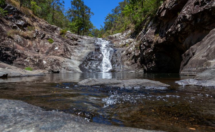
Filling the large rock pool at the base of the falls is a natural waterfall that runs all year round but is most spectacular in the wet season. One of the best things about these falls is that they can be seen from the Cedar Creek Falls lookout giving fantastic views of the gorge and waterfalls.
Tip: There are two shady picnic spots with toilets located near the start of the walking trail.
Where: 72-kilometres south of Brisbane or 40-kilometres from the Gold Coast at Cedar Creek, Mt Tamborine.
Difficulty: Easy. The hike to the cascades is only 500-metres on a paved path.
Road access: Car parking is available off Cedar Creek Falls Road.
Beechmont
Beechmont is in the Gold Coast Hinterland nestled between the Lamington Plateau and Tamborine Mountain. It is an extremely popular spot for day-trippers and bushwalkers.
At just 37-kilometres from the Gold Coast and 97-kilometres from Brisbane, it works as a day trip from either area. So why should you visit, well there are a couple of very pretty waterfalls here that provide a bit of challenge if you are up to it and it’s quite a pleasant drive.
Denham Falls
The walk to the enchanting Denham Falls in Beechmont starts at the Denham Reserve. It is a beautiful 3-kilometre round-trip walk through dense rainforest that runs adjacent to Back Creek Gorge.
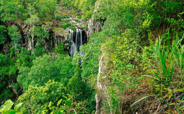
At the bottom of the falls is an oasis of lush vegetation surrounded by 30-metre high rock walls.
While it’s a challenging trail, it is worth the effort, as you are rewarded with a pretty waterfall and a generous swimming hole. Jump in and cool off and you will soon forget about the track!
Tip: If you don’t have the energy to do the whole walk there is a viewpoint with amazing views of the gorge and Denham Falls just before the downhill section of the track.
Where: Beechmont is 37-kilometres from the Gold Coast and 97-kilometres from Brisbane.
Difficulty: Hard for most. It is a 3-kilometre round trip walk on a steep and narrow path.
Road access: Doncaster Drive, Beechmont and starts at the Denham Reserve, where roadside car parking is available.
Lips Falls
Ok so this one is a big of a gamble. With the same starting point and walking track as Denham Falls, Lips Falls used to be a great place to swim on a hot summer day.
This curtain waterfall used to be a secluded gem known only to locals, but the word spread and access was cut off as it was overrun with visitors.
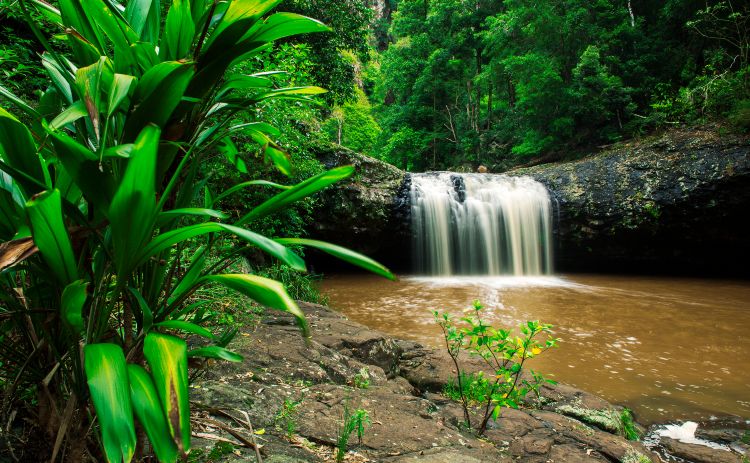
The falls are accessed via private property and when I last checked were closed to visitors. It’s not known if they will reopen but worth checking if you are in the area.
Tip: Additional waterfalls and swimming holes, known as the Beechmont Waterfall rock pools, can be found above Lips Falls.
Where: Beechmont is 37-kilometres from the Gold Coast and 97-kilometres from Brisbane.
Difficulty: Hard. It is a 3-kilometre round trip walk on a steep and narrow path.
Road access: Doncaster Drive, Beechmont, beginning at the Denham Reserve, where there is roadside car parking available.
Waterfalls further afield
Killarney, Southern Downs
Killarney in the Main Range National Park is home to The Falls Drive. It’s about 176km west of the Gold Coast or 181km southwest of Brisbane.
This is a great choice for anyone not up to hiking, as you can see most of these falls from lookouts along the side of the road.
Here you will discover five stunning waterfalls:
- Teviot Falls
- Queen Mary Falls
- Daggs Falls
- Browns Falls
- Upper Browns Falls.
It’s easy to cover all five in one day if you are taking them in from the lookouts!
Queen Mary Falls
Stroll along the Queen Mary Falls Circuit to the 40-metre natural beauty of Queen Mary Falls. The lookout from high above the falls will reward you with magical views of the waters from Spring creek plunging onto the valley floor.
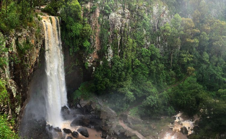
You can then continue along the track to the valley floor and cool off in the waterfall’s misty spray, and marvel at the rainbows created by the falls.
There is a picnic in the picnic area near the car park so this makes a great lunch stop.
Where: Located near the town of Killarney. From the Cunningham Highway, take the Lake Moogerah turnoff and continue it until it changes to Head Road and then turn into Spring Creek Road.
Difficulty: The walk is 2-kilometres return and is graded as moderate.
Road access: Car parking is available off Spring Creek Road, and the walk commences at Queen Mary Falls Circuit Picnic Area.
Browns Falls
Just outside of Killarney is Browns Falls, a 15-metre high waterfall that plunges spectacularly over basalt rock columns. The falls are reached by a short 600-metre walk with the rough-surfaced track following the lovely watercourse up to the falls. Afterwards, you can relax in the Browns Falls picnic area and enjoy a drink and bite to eat.
Tip: Watch for the red trail markers to navigate your way to the falls.
Where: 4.5-kilometres outside of Killarney
Difficulty: Moderate. The walking path can be muddy and involves creek crossing and rock scrambling.
Road access: Car park off Spring Creek Road with the walk starting from the Browns Falls picnic area.
Daggs Falls Lookout
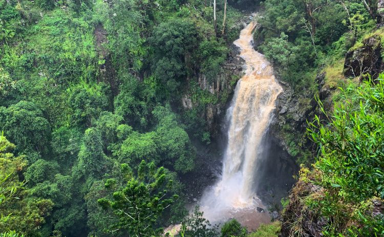
The tall and powerful Daggs Falls is located along The Falls Drive, between Browns Falls and Queen Mary Falls. The only way to observe this 38-metre plunging waterfall emanating from Teviot Brook is from the roadside lookout.
Where: 8-kilometres drive from Killarney.
Road Access: Daggs Falls Lookout car park is located off Spring Creek Road.
Have a question about travelling to Australia? Want to discover new places to visit? Head over to our group and join in all the fun.

